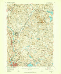
1957 Map of Suncook
USGS Topo · Published 1959About this map
The Merrimack River and its tributary, the Suncook River, define the industrial and agricultural corridors of central New Hampshire in the late 1950s. The landscape is dominated by the sprawling Bear Brook State Forest, a major recreational and conservation area that preserved the rugged interior terrain between the river valleys. Industrial centers like Manchester and Suncook are shown in detail, including the tracks of the Boston and Maine Railroad and early highway infrastructure like Interchange 11. Educational and institutional landmarks are particularly dense here, ranging from the Pembroke Academy and Mt St Mary College to the State Industrial Sch and the State Tech Sch. In the eastern sections, the transition to smaller rural villages such as Candia and East Candia reveals a pattern of ridge-top settlements and valley mill streams like Griffin Brook.
Find a feature on this map
176 named features on this map. Tap any name to fly to it.
Don’t see what you’re looking for? This feature index may not catch every label — zoom into the map to look around manually.
Map Details
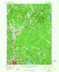
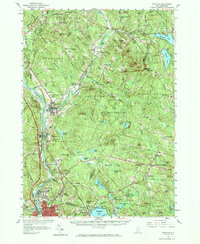
Editions of this 1957 Suncook Map
4 editions found

Other maps of this area

1888 · Haverhill
USGS Topo · 1:62,500

1890 · Haverhill
USGS Topo · 1:62,500

1893 · Haverhill
USGS Topo · 1:62,500

1905 · Manchester
USGS Topo · 1:62,500

1906 · Milford
USGS Topo · 1:62,500

1917 · Mt. Pawtuckaway
USGS Topo · 1:62,500

1919 · Mt. Pawtuckaway
USGS Topo · 1:62,500

1919 · Gilmanton
USGS Topo · 1:62,500

1919 · Alton
USGS Topo · 1:62,500

1921 · Suncook
USGS Topo · 1:62,500