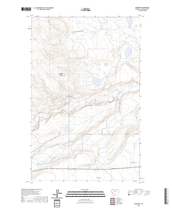
2024 Map of Sundance
USGS Topo · Published 2024About this map
Seville Colony stands as a focal point of settlement within this Glacier County landscape, situated amidst a complex network of glacial drainage features. The terrain is defined by deep incisions like Gillam Coulee and Wasteway Coulee, which channel runoff toward the meandering Cut Bank Creek. This contemporary survey illustrates the modern agricultural and water management infrastructure of the region, including the Q Lateral canal and rural corridors such as Pardue Rd and Johnson Rd. To the south, the broad expanse of Seville Flat leads toward the area known as Sundance, where Gunsight Rd traverses the plains. The map provides a precise look at how the natural coulee systems, like South Fork Little Rock Coulee, dictate the placement of roads and homesteads in this part of Montana.
Find a feature on this map
20 named features on this map. Tap any name to fly to it.
Don’t see what you’re looking for? This feature index may not catch every label — zoom into the map to look around manually.
Map Details
Editions of this 2024 Sundance Map
This is the sole edition of this map. No revisions or reprints were ever made.
Other maps of this area

1907 · Blackfoot Res.
USGS Topo · 1:48,000

1909 · Cut Bank
USGS Topo · 1:125,000

1911 · Blackfoot
USGS Topo · 1:125,000

1912 · Cut Bank
USGS Topo · 1:125,000

1960 · Cut Bank
USGS Topo · 1:250,000

1963 · Cut Bank
USGS Topo · 1:250,000

1964 · Cut Bank
USGS Topo · 1:250,000
1966 · Squaw Buttes
USGS Topo · 1:24,000
1966 · Gunsight
USGS Topo · 1:24,000

1968 · Buffalo Lake
USGS Topo · 1:24,000