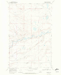
1968 Map of Sundance
USGS Topo · Published 1972About this map
The agricultural landscape of Glacier County comes into focus on this late 1960s survey, defined by the winding course of Cut Bank Creek and the critical infrastructure of high-plains farming. Near the southern edge of the sheet, the Burlington Northern railroad serves the settlement of Seville, providing a vital link for the grain handled at the Pardue Elevator. The topographical detail captures a complex network of water management, including the Two Medicine Main Canal and the Wasteway Lateral, which allowed for the cultivation of the surrounding Flat. Notable landmarks such as the small community of Sundance and a remote Landing Area near Gilliam Coulee provide specific points of interest for local historians studying the rural development and transit patterns of this era.
Find a feature on this map
11 named features on this map. Tap any name to fly to it.
Don’t see what you’re looking for? This feature index may not catch every label — zoom into the map to look around manually.
Map Details
Editions of this 1968 Sundance Map
This is the sole edition of this map. No revisions or reprints were ever made.
Other maps of this area

1907 · Blackfoot Res.
USGS Topo · 1:48,000

1909 · Cut Bank
USGS Topo · 1:125,000

1911 · Blackfoot
USGS Topo · 1:125,000

1912 · Cut Bank
USGS Topo · 1:125,000

1960 · Cut Bank
USGS Topo · 1:250,000

1963 · Cut Bank
USGS Topo · 1:250,000

1964 · Cut Bank
USGS Topo · 1:250,000
1966 · Squaw Buttes
USGS Topo · 1:24,000
1966 · Gunsight
USGS Topo · 1:24,000

1968 · Buffalo Lake
USGS Topo · 1:24,000