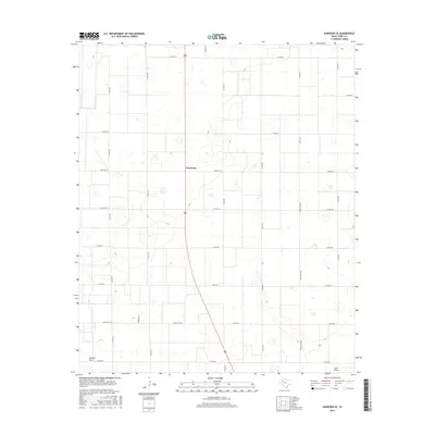
2016 Map of Sundown SE
USGS Topo · Published 2016About this map
Needmore serves as the central point of interest in this high plains landscape of Terry County, situated along the crossroads of Farm Rd 211 and Route 385. The region is defined by its characteristic drainage patterns, specifically the presence of Sulphur Draw in the southwest and Lost Draw in the southeast corner. These natural features, alongside numerous depressions across the terrain, reveal the semi-arid geography of the South Plains. The map details a strictly organized grid of agricultural and local access roads, including Thunder Rd and Ranch Rd 2196, which underscore the rural ranching and farming economy of the mid-2010s. This survey is particularly useful for identifying the specific intersections and ranch-to-market routes that connect the scattered farmsteads and rural homesites across this portion of the Texas panhandle.
Find a feature on this map
22 named features on this map. Tap any name to fly to it.
Don’t see what you’re looking for? This feature index may not catch every label — zoom into the map to look around manually.
Map Details
Editions of this 2016 Sundown SE Map
This is the sole edition of this map. No revisions or reprints were ever made.
Other maps of this area

1954 · Brownfield
USGS Topo · 1:250,000

1957 · Meadow
USGS Topo · 1:62,500

1958 · Brownfield
USGS Topo · 1:250,000

1962 · Brownfield
USGS Topo · 1:250,000

1965 · Sundown
USGS Topo · 1:24,000

1965 · Lockettville
USGS Topo · 1:24,000

1969 · Brownfield East
USGS Topo · 1:24,000

1969 · Gomez
USGS Topo · 1:24,000

1969 · Sundown SE
USGS Topo · 1:24,000

1969 · Pool
USGS Topo · 1:24,000