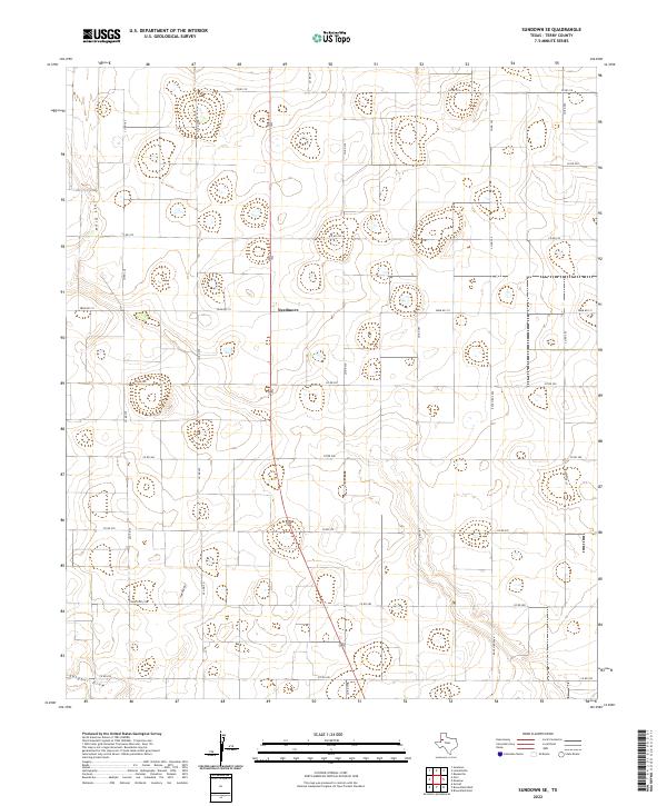
2022 Map of Sundown SE
USGS Topo · Published 2022About this map
Needmore serves as a central point in this southern Terry County landscape, where the flat High Plains are defined by a precise grid of rural transit. The terrain is marked by the subtle depressions of ephemeral watercourses, specifically Lost Draw in the northwest and Sulphur Draw along the southern edge. These drainage features provide the primary relief in an otherwise strictly partitioned agricultural environment. A dense network of county roads, including Co Rd 210 and Co Rd 371, connects dispersed farmsteads and agricultural operations. Larger thoroughfares such as Farm Rd 211 and Ranch Rd 2196 facilitate movement across the plains, while uniquely named local routes like Thunder Rd offer specific points of interest for those tracing family land holdings or local travel patterns in this contemporary Texas interior.
Find a feature on this map
22 named features on this map. Tap any name to fly to it.
Don’t see what you’re looking for? This feature index may not catch every label — zoom into the map to look around manually.
Map Details
Editions of this 2022 Sundown SE Map
This is the sole edition of this map. No revisions or reprints were ever made.
Other maps of this area

1954 · Brownfield
USGS Topo · 1:250,000

1957 · Meadow
USGS Topo · 1:62,500

1958 · Brownfield
USGS Topo · 1:250,000

1962 · Brownfield
USGS Topo · 1:250,000

1965 · Sundown
USGS Topo · 1:24,000

1965 · Lockettville
USGS Topo · 1:24,000

1969 · Brownfield East
USGS Topo · 1:24,000

1969 · Gomez
USGS Topo · 1:24,000

1969 · Sundown SE
USGS Topo · 1:24,000

1969 · Pool
USGS Topo · 1:24,000