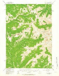
1956 Map of Sunlight Peak
USGS Topo · Published 1963About this map
Pahaska Tepee stands at the southern edge of this mid-century survey, marking a significant entry point into the high wilderness of the Absaroka Range. The landscape is a complex intersection of the eastern boundary of Yellowstone National Park and the rugged reaches of the Shoshone National Forest. High-altitude infrastructure is represented by the Upper Lamar River Patrol Sta and various backcountry shelters like the Hardee Cabins and Painter Cabin.
Find a feature on this map
68 named features on this map. Tap any name to fly to it.
Don’t see what you’re looking for? This feature index may not catch every label — zoom into the map to look around manually.
Map Details
Editions of this 1956 Sunlight Peak Map
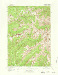
4 editions found

Other maps of this area

1885 · Lake
USGS Topo · 1:125,000

1886 · Canyon
USGS Topo · 1:125,000

1893 · Ishawooa
USGS Topo · 1:125,000

1895 · Ishawooa
USGS Topo · 1:125,000

1895 · Canyon
USGS Topo · 1:125,000

1895 · Lake
USGS Topo · 1:125,000

1896 · Lake
USGS Topo · 1:125,000

1896 · Canyon
USGS Topo · 1:125,000

1896 · Crandall Creek
USGS Topo · 1:125,000

1899 · Crandall
USGS Topo · 1:125,000