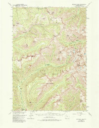
1956 Map of Sunlight Peak
USGS Topo · Published 1980About this map
The Absaroka Range dominates this mid-century survey, where the boundaries of Yellowstone National Park meet the Shoshone National Forest. High-altitude land management is evident through the placement of the Upper Miller Creek Patrol Sta and Upper Lamar River Patrol Sta, serving as remote outposts for park rangers and foresters. The landscape is a complex network of peaks and drainages, notably the Sunlight Mining Region situated between the Sunlight Creek and Silverlip Basin. This area highlights the legacy of early prospecting and extraction efforts in the high mountains of Wyoming.
Find a feature on this map
57 named features on this map. Tap any name to fly to it.
Don’t see what you’re looking for? This feature index may not catch every label — zoom into the map to look around manually.
Map Details
Editions of this 1956 Sunlight Peak Map
4 editions found

Other maps of this area

1885 · Lake
USGS Topo · 1:125,000

1886 · Canyon
USGS Topo · 1:125,000

1893 · Ishawooa
USGS Topo · 1:125,000

1895 · Ishawooa
USGS Topo · 1:125,000

1895 · Canyon
USGS Topo · 1:125,000

1895 · Lake
USGS Topo · 1:125,000

1896 · Lake
USGS Topo · 1:125,000

1896 · Canyon
USGS Topo · 1:125,000

1896 · Crandall Creek
USGS Topo · 1:125,000

1899 · Crandall
USGS Topo · 1:125,000