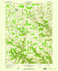
1958 Map of Sunman
USGS Topo · Published 1959About this map
The New York Central railroad cuts a diagonal path across the northern reaches of this territory, connecting the established rail town of Sunman to the outlying landscape of Dearborn and Ripley counties. This mid-century survey illustrates a rural society organized around crossroads communities and church parishes, including New Alsace, Weisburg, and Negangards Corner. Notable landmarks such as the County Home and Township Sch provide a view into the civic infrastructure of the era, while the Treaty Line road serves as a persistent reminder of early land surveys and historical boundaries.
Find a feature on this map
49 named features on this map. Tap any name to fly to it.
Don’t see what you’re looking for? This feature index may not catch every label — zoom into the map to look around manually.
Map Details
Editions of this 1958 Sunman Map
3 editions found

Other maps of this area

1915 · Lawrenceburg
USGS Topo · 1:48,000

1915 · Harrison
USGS Topo · 1:48,000

1928 · Lawrenceburg
USGS Topo · 1:62,500

1932 · Lawrenceburg
USGS Topo · 1:62,500

1943 · Aurora
USGS Topo · 1:24,000

1943 · Guilford
USGS Topo · 1:24,000

1946 · Milan
USGS Topo · 1:24,000

1946 · Pierceville
USGS Topo · 1:24,000

1946 · Batesville
USGS Topo · 1:24,000

1953 · Aurora
USGS Topo · 1:24,000