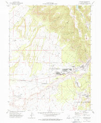
1972 Map of Sunnyside
USGS Topo · Published 1988About this map
Industrial activity and high-desert settlement define this landscape in the early 1970s. The coal-rich corridor along the Denver and Rio Grande Western and the Carbon County Railway anchors towns like Sunnyside and Columbia, where extensive Coke Ovens and Tailings piles signify the region's mining foundations. The planned residential layout of Dragerton and the expansion of East Carbon City showcase mid-century growth, supported by institutions like the East Carbon High Sch and Petersen Sch.
Find a feature on this map
40 named features on this map. Tap any name to fly to it.
Don’t see what you’re looking for? This feature index may not catch every label — zoom into the map to look around manually.
Map Details
Editions of this 1972 Sunnyside Map
2 editions found
Other maps of this area

1886 · Price River
USGS Topo · 1:250,000

1896 · Price River
USGS Topo · 1:250,000

1915 · Sunnyside
USGS Topo · 1:62,500

1915 · Wellington
USGS Topo · 1:62,500

1948 · Woodside
USGS Topo · 1:62,500

1949 · Woodside
USGS Topo · 1:62,500

1950 · Woodside
USGS Topo · 1:62,500

1956 · Price
USGS Topo · 1:250,000

1960 · Price
USGS Topo · 1:250,000

1962 · Price
USGS Topo · 1:250,000