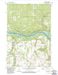
1983 Map of Sunrise
USGS Topo · Published 1987About this map
The St-Croix River corridor defines this borderland landscape where Minnesota meets Wisconsin, a region preserved under the St Croix National Scenic Riverway. In the early 1980s, the terrain shows a mix of protected wild lands and small-scale settlements like Sunrise and Amador. The Wisconsin side is dominated by the dense wooded expanse of the Governor Knowles State Forest, while the Minnesota side includes recreational points like the Boat Ramp and Public Access. Evidence of early pioneer history is found at the Old Settlers Cem near the Trade River and the Sunrise Cem further south. The transportation network reflects a recreational and rural character, featuring the Sunrise Ferry Hiking Trail and various Snowmobile Trails alongside the meandering Sunrise River and its tributary, North Br Hay Cr.
Find a feature on this map
23 named features on this map. Tap any name to fly to it.
Don’t see what you’re looking for? This feature index may not catch every label — zoom into the map to look around manually.
Map Details
Editions of this 1983 Sunrise Map
2 editions found
Other maps of this area

1900 · St Croix Dalles
USGS Topo · 1:62,500

1901 · St Croix Dalles
USGS Topo · 1:62,500

1950 · Rush City
USGS Topo · 1:48,000

1951 · Milltown
USGS Topo · 1:48,000

1953 · Stillwater
USGS Topo · 1:250,000

1955 · St. Croix Dalles
USGS Topo · 1:62,500

1955 · Rush City
USGS Topo · 1:62,500

1955 · Milltown
USGS Topo · 1:62,500

1955 · Forest Lake
USGS Topo · 1:62,500

1955 · Stillwater
USGS Topo · 1:250,000