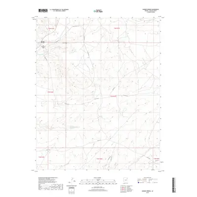
2018 Map of Sunrise Springs
USGS Topo · Published 2018About this map
Sunrise Springs is situated in a high-desert landscape defined by intricate drainage systems and seasonal water sources. The terrain is marked by significant features like Ruins Ridge and the Ruins Wash, suggesting a landscape shaped by ancient geological processes and perhaps historic habitation. The central portion of the map is dominated by the Pueblo Colorado Wash, which runs alongside Big Wilderness Wash. Infrastructure is sparse but critical, consisting of a network of regional routes such as Indian Rte 28 and Indian Rte 9205, which connect these remote areas. Of particular note for local geography is the Big Dam Reservoir, providing a rare point of managed water storage in an otherwise arid environment. Small, localized water points like Shonto Spring remain vital landmarks in this part of Apache County, illustrating the delicate balance of resources in the high plateau country.
Find a feature on this map
22 named features on this map. Tap any name to fly to it.
Don’t see what you’re looking for? This feature index may not catch every label — zoom into the map to look around manually.
Map Details
Editions of this 2018 Sunrise Springs Map
This is the sole edition of this map. No revisions or reprints were ever made.
Other maps of this area

1886 · Fort Defiance
USGS Topo · 1:250,000

1892 · Fort Defiance
USGS Topo · 1:250,000

1954 · Gallup
USGS Topo · 1:250,000

1958 · Gallup
USGS Topo · 1:250,000

1959 · Gallup
USGS Topo · 1:250,000

1962 · Gallup
USGS Topo · 1:250,000

1967 · Gallup
USGS Topo · 1:250,000
1972 · Steamboat Canyon
USGS Topo · 1:24,000
1972 · Greasewood
USGS Topo · 1:24,000
1972 · Boggy Lake Well
USGS Topo · 1:24,000
Featured Places
- Fort Defiance Agency
- Kin Łigaaí, Fort Defiance Agency
- Ałchʼįʼáhootʼé, Fort Defiance Agency
- Sunrise Springs, Fort Defiance Agency
- Apache County, AZ