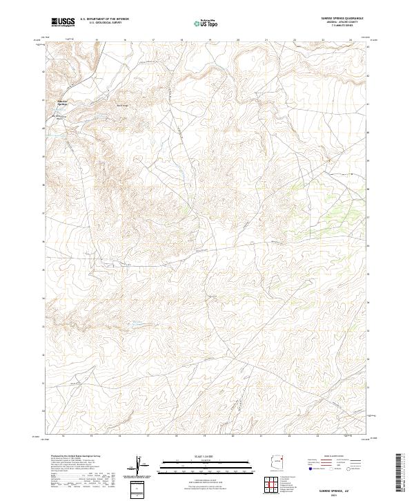
2021 Map of Sunrise Springs
USGS Topo · Published 2021About this map
Sunrise Springs serves as the primary landmark in this corner of the Navajo Nation within Apache County. The landscape is defined by its drainage systems and high ground, notably Ruins Ridge and the accompanying Ruins Wash. Water resources, though sparse, are carefully marked, ranging from the localized Shonto Spring to the more substantial Big Dam Reservoir located in the southern half of the quadrangle.
Find a feature on this map
24 named features on this map. Tap any name to fly to it.
Don’t see what you’re looking for? This feature index may not catch every label — zoom into the map to look around manually.
Map Details
Editions of this 2021 Sunrise Springs Map
This is the sole edition of this map. No revisions or reprints were ever made.
Other maps of this area
1886 · Fort Defiance
USGS Topo · 1:250,000
1892 · Fort Defiance
USGS Topo · 1:250,000
1954 · Gallup
USGS Topo · 1:250,000
1958 · Gallup
USGS Topo · 1:250,000
1959 · Gallup
USGS Topo · 1:250,000
1962 · Gallup
USGS Topo · 1:250,000
1967 · Gallup
USGS Topo · 1:250,000
1972 · Steamboat Canyon
USGS Topo · 1:24,000
1972 · Greasewood
USGS Topo · 1:24,000
1972 · Boggy Lake Well
USGS Topo · 1:24,000
Featured Places
- Fort Defiance Agency
- Ałchʼįʼáhootʼé, Fort Defiance Agency
- Kin Łigaaí, Fort Defiance Agency
- Sunrise Springs, Fort Defiance Agency
- Apache County, AZ