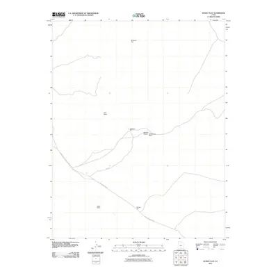
2011 Map of Sunset Flat
USGS Topo · Published 2011About this map
Hole In The Rock Rd cuts a diagonal path across this high desert landscape, tracing a route with deep ties to the region's pioneering history. The terrain is defined by broad plateaus and drainages, where Buckaroo Flat and Sunset Flat provide relatively level expanses between the dissected drainages of Twentymile Wash. This 2011 survey captures the remote character of Kane County, focusing on a junction of backcountry routes where Egypt Rd meets the main thoroughfare near the Twentyfive Mile Corral. The map details the local hydrology and topography around landmarks like White Point and the curiously named Rat Seep Hollow. Much of the western portion falls within the jurisdiction of the Glen Canyon National Recreation Area, emphasizing the area's role as a protected wilderness and ranching corridor.
Find a feature on this map
11 named features on this map. Tap any name to fly to it.
Don’t see what you’re looking for? This feature index may not catch every label — zoom into the map to look around manually.
Map Details
Editions of this 2011 Sunset Flat Map
This is the sole edition of this map. No revisions or reprints were ever made.
Other maps of this area

1886 · Escalante
USGS Topo · 1:250,000

1922 · Rees Canyon
USGS Topo · 1:63,360

1953 · Circle Cliffs 4 NW
USGS Topo · 1:24,000

1953 · Circle Cliffs 4 SW
USGS Topo · 1:24,000

1953 · Moody Creek
USGS Topo · 1:62,500

1956 · Escalante
USGS Topo · 1:250,000

1960 · Escalante
USGS Topo · 1:250,000

1964 · Sunset Flat
USGS Topo · 1:24,000

1964 · Tenmile Flat
USGS Topo · 1:24,000

1964 · Seep Flat
USGS Topo · 1:24,000