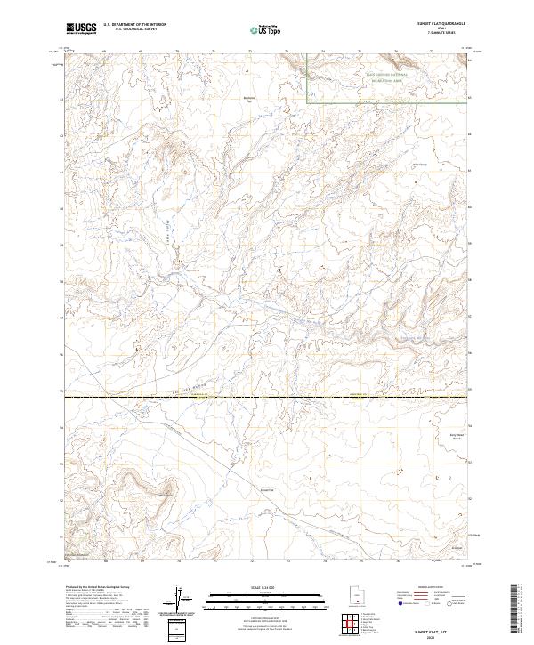
2023 Map of Sunset Flat
USGS Topo · Published 2023About this map
Hole In The Rock Rd cuts across this high desert landscape, tracing a path through the southern reaches of Garfield County near the border of Kane County. The terrain is defined by a series of expansive benches and flats, most notably Sunset Flat and Buckaroo Flat, separated by deep drainage systems. Twentymile Wash and the winding Twentyfive-Mile Wash provide the primary hydrological structure for the area, carving through the earth toward the Glen Canyon National Recreation Area visible in the northeast corner.
Find a feature on this map
15 named features on this map. Tap any name to fly to it.
Don’t see what you’re looking for? This feature index may not catch every label — zoom into the map to look around manually.
Map Details
Editions of this 2023 Sunset Flat Map
This is the sole edition of this map. No revisions or reprints were ever made.
Other maps of this area

1886 · Escalante
USGS Topo · 1:250,000

1922 · Rees Canyon
USGS Topo · 1:63,360

1953 · Circle Cliffs 4 NW
USGS Topo · 1:24,000

1953 · Circle Cliffs 4 SW
USGS Topo · 1:24,000

1953 · Moody Creek
USGS Topo · 1:62,500

1956 · Escalante
USGS Topo · 1:250,000

1960 · Escalante
USGS Topo · 1:250,000

1964 · Sunset Flat
USGS Topo · 1:24,000

1964 · Tenmile Flat
USGS Topo · 1:24,000

1964 · Seep Flat
USGS Topo · 1:24,000