
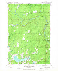
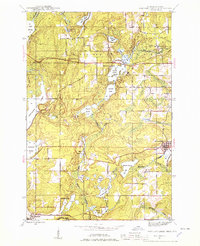
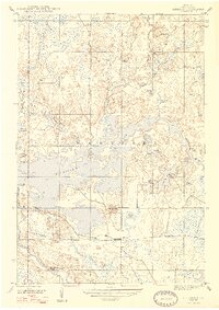
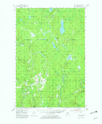
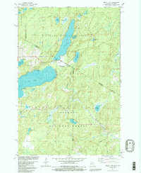
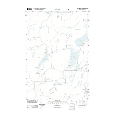
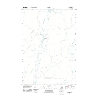
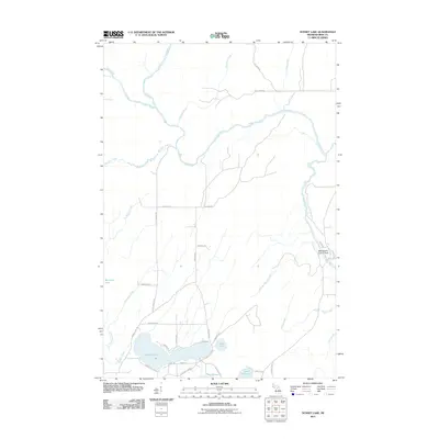
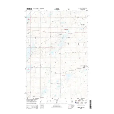
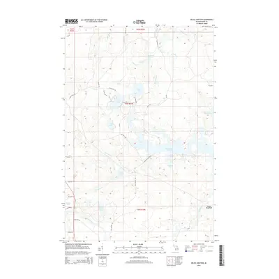
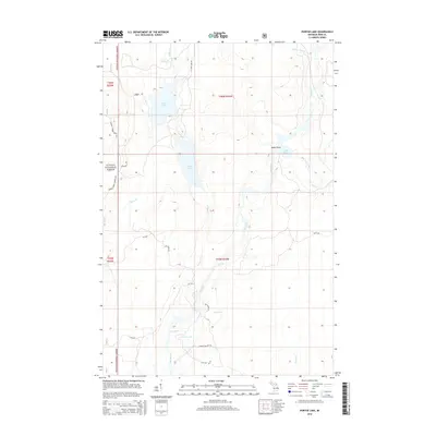
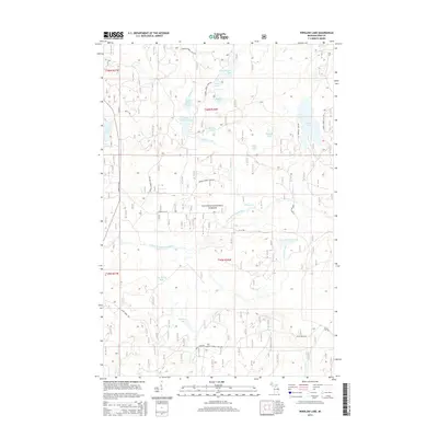
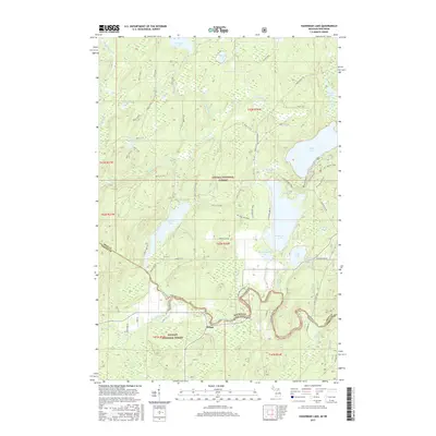
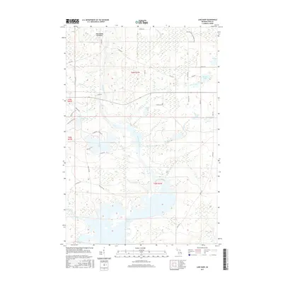
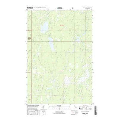
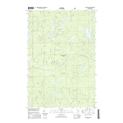
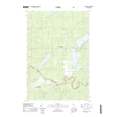
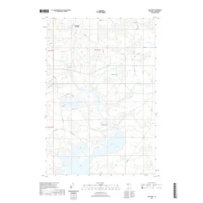
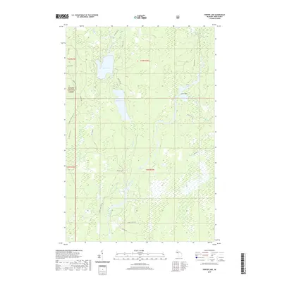
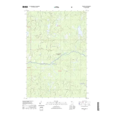
1945 Map of Sunset Lake
USGS Topo · Published 1981About this map
The Ottawa National Forest dominates the landscape of this mid-century survey, where the confluence of the Net River and Paint River defines the local geography. The small settlement of Sunset is positioned at the southwestern edge, near the expansive waters of Sunset Lake. This map records a time when the hydraulic industrial footprint was already receding, notably marked by the Paint Dam (Abandoned) downstream.
Find a feature on this map
26 named features on this map. Tap any name to fly to it.
Don’t see what you’re looking for? This feature index may not catch every label — zoom into the map to look around manually.
Map Details
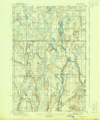
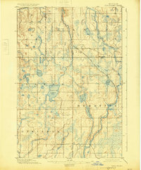
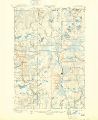
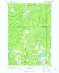
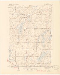
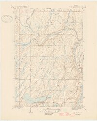
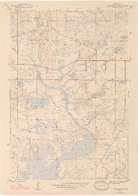
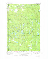
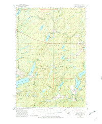
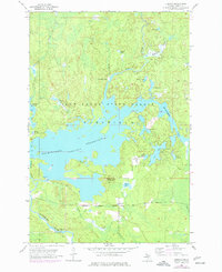
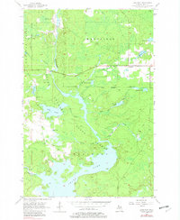
Editions of this 1945 Sunset Lake Map
3 editions found

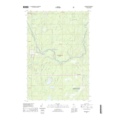
Historical Maps of Hematite Township Through Time
133 maps found
1895 Ned Lake
Iron County, MI
1895 Perch Lake
Iron County, MI
1899 Sagola
Iron County, MI

1943 Little Girl Point
Iron County, MI
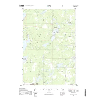
1944 Fortune Lakes
Iron County, MI
1945 Gibbs City
Iron County, MI

1945 Kelso Junction
Iron County, MI
1945 Sunset Lake
Iron County, MI

1946 Fortune Lakes
Iron County, MI
1946 Gibbs City
Iron County, MI
1946 Sunset Lake
Iron County, MI

1947 Kelso Junction
Iron County, MI
1947 Kiernan
Iron County, MI
1947 Lake Mary
Iron County, MI
1954 Kenton
Iron County, MI
1954 Perch Lake
Iron County, MI
1955 Ned Lake
Iron County, MI
1956 Beechwood
Iron County, MI
1956 Kiernan
Iron County, MI
1956 Lake Mary
Iron County, MI

1956 Sagola
Iron County, MI

1962 Naults
Iron County, MI

1981 Beechwood
Iron County, MI

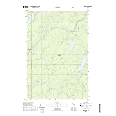
1981 Golden Lake
Iron County, MI

1981 Hagerman Lake
Iron County, MI
1981 Smoky Lake
Iron County, MI

1982 Lake Mitigwaki
Iron County, MI

1982 Winslow Lake
Iron County, MI

1985 Hickman Lake
Iron County, MI

1985 Ned Lake SE
Iron County, MI

1985 Perch Lake
Iron County, MI

1985 Porter Lake
Iron County, MI

1985 Triangle Ranch
Iron County, MI

1999 Beechwood
Iron County, MI

1999 Gibbs City
Iron County, MI

1999 Golden Lake
Iron County, MI

1999 Hagerman Lake
Iron County, MI

1999 Lake Mitigwaki
Iron County, MI

1999 Perch Lake
Iron County, MI

1999 Smoky Lake
Iron County, MI

1999 Sunset Lake
Iron County, MI

1999 Winslow Lake
Iron County, MI
2011 Beechwood
Iron County, MI
2011 Fortune Lakes
Iron County, MI

2011 Gibbs City
Iron County, MI
2011 Golden Lake
Iron County, MI
2011 Hagerman Lake
Iron County, MI
2011 Hickman Lake
Iron County, MI
2011 Kelso Junction
Iron County, MI

2011 Kiernan
Iron County, MI

2011 Lake Mary
Iron County, MI
2011 Lake Mitigwaki
Iron County, MI

2011 Naults
Iron County, MI
2011 Ned Lake SE
Iron County, MI
2011 Perch Lake
Iron County, MI
2011 Porter Lake
Iron County, MI
2011 Smoky Lake
Iron County, MI
2011 Sunset Lake
Iron County, MI
2011 Triangle Ranch
Iron County, MI
2011 Winslow Lake
Iron County, MI

2013 Naults
Iron County, MI
2014 Beechwood
Iron County, MI
2014 Fortune Lakes
Iron County, MI

2014 Gibbs City
Iron County, MI
2014 Golden Lake
Iron County, MI
2014 Hagerman Lake
Iron County, MI
2014 Hickman Lake
Iron County, MI
2014 Kelso Junction
Iron County, MI

2014 Kiernan
Iron County, MI

2014 Lake Mary
Iron County, MI
2014 Lake Mitigwaki
Iron County, MI

2014 Naults
Iron County, MI
2014 Ned Lake SE
Iron County, MI
2014 Perch Lake
Iron County, MI
2014 Porter Lake
Iron County, MI
2014 Smoky Lake
Iron County, MI
2014 Sunset Lake
Iron County, MI
2014 Triangle Ranch
Iron County, MI
2014 Winslow Lake
Iron County, MI
2017 Beechwood
Iron County, MI
2017 Fortune Lakes
Iron County, MI

2017 Gibbs City
Iron County, MI
2017 Golden Lake
Iron County, MI
2017 Hagerman Lake
Iron County, MI
2017 Hickman Lake
Iron County, MI
2017 Kelso Junction
Iron County, MI
2017 Kiernan
Iron County, MI
2017 Lake Mary
Iron County, MI
2017 Lake Mitigwaki
Iron County, MI

2017 Naults
Iron County, MI
2017 Ned Lake SE
Iron County, MI
2017 Perch Lake
Iron County, MI
2017 Porter Lake
Iron County, MI
2017 Smoky Lake
Iron County, MI
2017 Sunset Lake
Iron County, MI
2017 Triangle Ranch
Iron County, MI
2017 Winslow Lake
Iron County, MI
2019 Beechwood
Iron County, MI
2019 Fortune Lakes
Iron County, MI

2019 Gibbs City
Iron County, MI
2019 Golden Lake
Iron County, MI
2019 Hagerman Lake
Iron County, MI
2019 Hickman Lake
Iron County, MI
2019 Kelso Junction
Iron County, MI
2019 Kiernan
Iron County, MI
2019 Lake Mary
Iron County, MI
2019 Lake Mitigwaki
Iron County, MI

2019 Naults
Iron County, MI
2019 Ned Lake SE
Iron County, MI
2019 Perch Lake
Iron County, MI
2019 Porter Lake
Iron County, MI
2019 Smoky Lake
Iron County, MI
2019 Sunset Lake
Iron County, MI
2019 Triangle Ranch
Iron County, MI
2019 Winslow Lake
Iron County, MI

2023 Beechwood
Iron County, MI

2023 Fortune Lakes
Iron County, MI

2023 Gibbs City
Iron County, MI

2023 Golden Lake
Iron County, MI

2023 Hagerman Lake
Iron County, MI

2023 Hickman Lake
Iron County, MI
2023 Kelso Junction
Iron County, MI

2023 Kiernan
Iron County, MI

2023 Lake Mary
Iron County, MI

2023 Lake Mitigwaki
Iron County, MI

2023 Naults
Iron County, MI

2023 Ned Lake SE
Iron County, MI

2023 Perch Lake
Iron County, MI
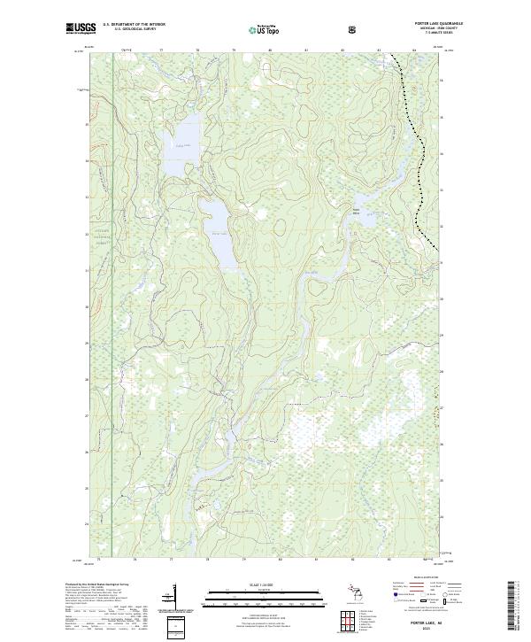
2023 Porter Lake
Iron County, MI

2023 Smoky Lake
Iron County, MI

2023 Sunset Lake
Iron County, MI
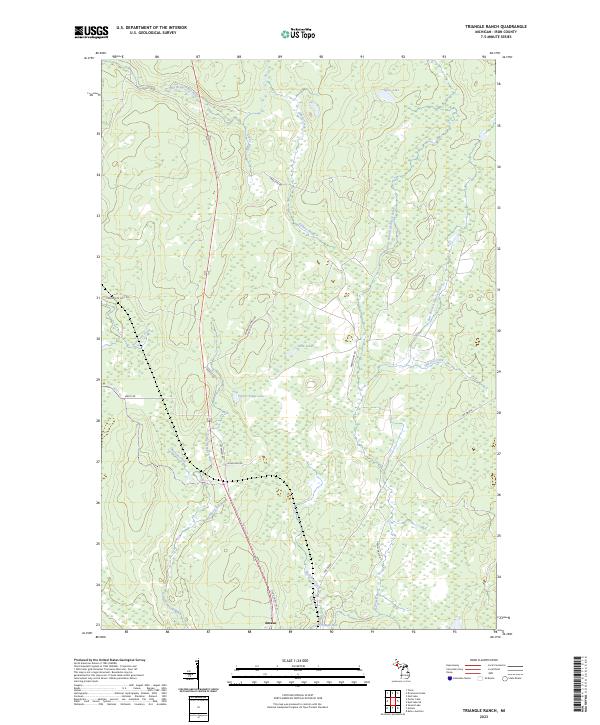
2023 Triangle Ranch
Iron County, MI

2023 Winslow Lake
Iron County, MI