1945 Map of Sunset Lake
USGS Topo · Published 1967About this map
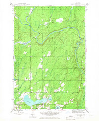
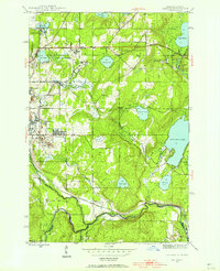
Sunset Lake and its surrounding timberlands define this 1945 landscape within Bates township. The terrain is a complex network of waterways, where the Net River joins the Paint River amidst the dense stands of the Ottawa National Forest. A notable industrial remnant is the Paint Dam (Abandoned) located on the eastern branch of the river, signaling a shift in local water management or logging practices during the mid-century. Downstream, the river breaks into Hemlock Rapids and Lower Hemlock Rapids, illustrating the natural obstacles once navigated by woodsmen. Numerous small glacial lakes, including Lake Sixteen, Lake Nine, and Lake Fifteen, are connected by a web of creeks such as Costigan Creek and the distinctively named Me-Squan-Cum-E Park Creek.
Find a feature on this map
21 named features on this map. Tap any name to fly to it.
Don’t see what you’re looking for? This feature index may not catch every label — zoom into the map to look around manually.
Map Details
Editions of this 1945 Sunset Lake Map
3 editions found

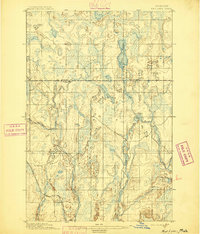
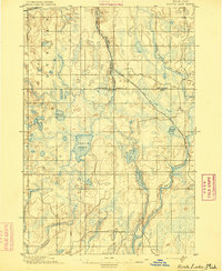
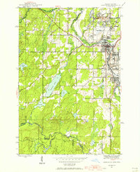
Other maps of this area
1895 · Ned Lake
USGS Topo · 1:62,500
1895 · Perch Lake
USGS Topo · 1:62,500

1898 · Iron River
USGS Topo · 1:62,500

1899 · Crystal Falls
USGS Topo · 1:62,500
1944 · Iron River
USGS Topo · 1:24,000
1944 · Gaastra
USGS Topo · 1:24,000
1944 · Fortune Lakes
USGS Topo · 1:24,000
1945 · Gibbs City
USGS Topo · 1:24,000

1945 · Sunset Lake
USGS Topo · 1:24,000
1945 · Amasa
USGS Topo · 1:24,000