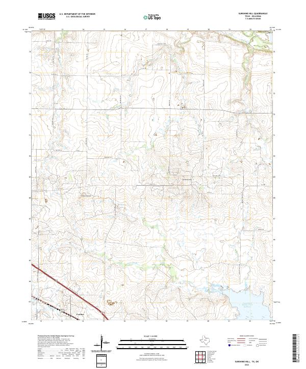
2022 Map of Sunshine Hill
USGS Topo · Published 2022About this map
Sunshine Hill and Floral Mound anchor this landscape of the North Texas plains, where the terrain is defined by the dendritic drainage of Cole Cr and Long Cr. The agricultural and ranching character of the region is evident in the dense network of rural routes such as Burnett Ranch Rd and Barwise Rd, which connect scattered homesteads and small settlements. To the south, the village of Fowlkes sits near the rail and highway corridor, while Midway Church serves as a local landmark along the southwestern edge.
Find a feature on this map
35 named features on this map. Tap any name to fly to it.
Don’t see what you’re looking for? This feature index may not catch every label — zoom into the map to look around manually.
Map Details
Editions of this 2022 Sunshine Hill Map
This is the sole edition of this map. No revisions or reprints were ever made.
Other maps of this area

1915 · Clara
USGS Topo · 1:24,000

1915 · Barwise School
USGS Topo · 1:24,000

1916 · Electra
USGS Topo · 1:24,000

1916 · Iowa Park
USGS Topo · 1:24,000

1916 · Fowlkes
USGS Topo · 1:24,000

1917 · Beaver Creek
USGS Topo · 1:24,000

1918 · Electra
USGS Topo · 1:31,680

1918 · Barwise School
USGS Topo · 1:31,680

1918 · Clara
USGS Topo · 1:31,680

1918 · Iowa Park
USGS Topo · 1:31,680