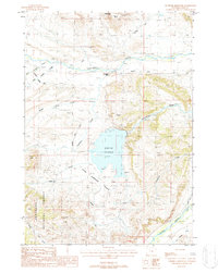
1987 Map of Sunshine Reservoir
USGS Topo · Published 1988About this map
The Sunshine Reservoir dominates this high-plains landscape, serving as a critical water management hub for the arid ranching and energy country of northwest Wyoming. Situated along the Greybull River and near the eastern edge of the Shoshone National Forest, the map illustrates a complex network of irrigation infrastructure essential for regional agriculture. Engineered waterways like the Sunshine Supply Ditch, Pappapau Ditch, and Nelson Ditch trace the contours of the Upper Sunshine Basin, reflecting the decades-long effort to divert alpine runoff to the fertile valley floors.
Find a feature on this map
26 named features on this map. Tap any name to fly to it.
Don’t see what you’re looking for? This feature index may not catch every label — zoom into the map to look around manually.
Map Details
Editions of this 1987 Sunshine Reservoir Map
This is the sole edition of this map. No revisions or reprints were ever made.
Other maps of this area

1904 · Kirwin
USGS Topo · 1:125,000

1906 · Kirwin
USGS Topo · 1:125,000

1911 · Meeteetse
USGS Topo · 1:62,500

1913 · Meeteetse
USGS Topo · 1:62,500

1955 · Cody
USGS Topo · 1:250,000

1955 · Thermopolis
USGS Topo · 1:250,000

1956 · Soapy Dale Peak
USGS Topo · 1:24,000

1957 · Sunshine Reservoir
USGS Topo · 1:62,500

1958 · Cody
USGS Topo · 1:250,000

1958 · Thermopolis
USGS Topo · 1:250,000