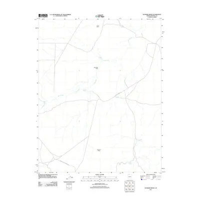
2011 Map of Sunshine Ridge
USGS Topo · Published 2011About this map
Sunshine Ridge anchors this portion of the Arizona Strip, a remote landscape defined by its seasonal watercourses and high-desert terrain near the northern boundary of Grand Canyon National Park. The land's cattle-ranching utility is evident through a series of human-made water catchments, including Jackson Reservoir, Tom Lamb Reservoir, and the CCC Trail Reservoir. These features, along with Caanan Reservoir and Wild Band Reservoir, highlight the critical importance of water management in Wild Band Valley. Drainage is naturally facilitated by Bulrush Wash and Yellowstone Wash, which cut through the arid flats. Transportation is centered on the historic Mount Trumbull Rd, providing one of the few established routes across this high plateau. The topography is further marked by prominent elevations such as Cedar Knoll, which serves as a landmark in the northern section of the map.
Find a feature on this map
13 named features on this map. Tap any name to fly to it.
Don’t see what you’re looking for? This feature index may not catch every label — zoom into the map to look around manually.
Map Details
Editions of this 2011 Sunshine Ridge Map
This is the sole edition of this map. No revisions or reprints were ever made.
Other maps of this area

1886 · Kaibab
USGS Topo · 1:250,000

1953 · Grand Canyon
USGS Topo · 1:250,000

1954 · Heaton Knolls NW
USGS Topo · 1:24,000
1954 · Short Creek SW
USGS Topo · 1:24,000

1954 · Short Creek SE
USGS Topo · 1:24,000

1954 · Heaton Knolls SE
USGS Topo · 1:24,000

1954 · Fredonia SW
USGS Topo · 1:24,000

1954 · Fredonia
USGS Topo · 1:62,500

1954 · Short Creek
USGS Topo · 1:62,500

1954 · Heaton Knolls
USGS Topo · 1:62,500