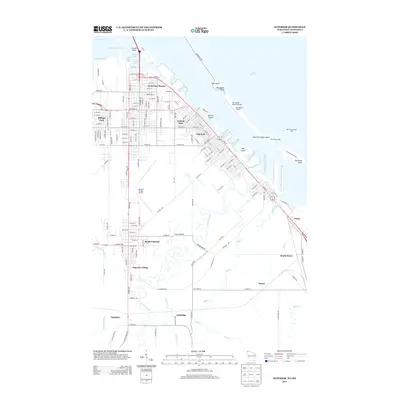
2013 Map of Superior
USGS Topo · Published 2013About this map
Sky Harbor Airport and the Sky Harbor Seaplane Base sit at the end of Minnesota Point, where the harbor meets the open waters of Lake Superior. This survey captures the complex industrial and maritime geography of the Twin Ports area, focusing on the Wisconsin side. The urban grid of East End and Park Place Homes transitions into the heavy infrastructure of the Superior Harbor Basin, defined by deep-water slips like Howards Bay and Hughitt Slip. Further south, the map reveals a collection of rail-oriented settlements including Itasca, Ambridge, and Saunders, showing how transportation networks shaped the growth of these neighborhoods near the Nemadji River. The presence of the Richard I Bong Airport and extensive NP Railroad tracks highlights the region's importance as a logistics hub for the Great Lakes.
Find a feature on this map
108 named features on this map. Tap any name to fly to it.
Don’t see what you’re looking for? This feature index may not catch every label — zoom into the map to look around manually.
Map Details
Editions of this 2013 Superior Map
This is the sole edition of this map. No revisions or reprints were ever made.
Other maps of this area

1895 · Duluth
USGS Topo · 1:62,500

1915 · Superior
USGS Topo · 1:48,000

1917 · Superior
USGS Topo · 1:62,500

1949 · Poplar
USGS Topo · 1:48,000

1953 · Lakewood
USGS Topo · 1:24,000

1953 · Duluth
USGS Topo · 1:24,000

1953 · Duluth Heights
USGS Topo · 1:24,000

1953 · Duluth
USGS Topo · 1:62,500

1953 · Ashland
USGS Topo · 1:250,000

1953 · Duluth
USGS Topo · 1:250,000