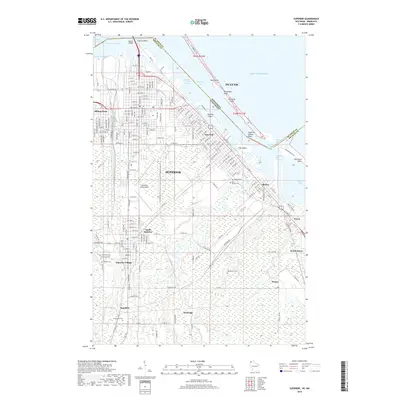
2018 Map of Superior
USGS Topo · Published 2018About this map
The Nemadji River and Saint Louis River converge at the tip of Lake Superior, defining the industrial and maritime layout of this 21st-century border region. This map illustrates the dense urban neighborhoods of Superior, Wisconsin, alongside the waterfront infrastructure of Duluth, Minnesota. The twin ports are linked by the Blatnik Bridge, which spans the Saint Louis River near Connors Point. The landscape is characterized by its complex hydrology, featuring the Superior Harbor Basin and numerous low-lying islands like Barkers Island and Hog Island. Away from the busy waterfront, the map detail extends to inland settlements such as South Superior, Itasca, and Ambridge. This edition is particularly useful for genealogists, as it documents a high concentration of burial grounds, including Nemadji Cem, Hebrew Cem, and Woodlawn Cem.
Find a feature on this map
53 named features on this map. Tap any name to fly to it.
Don’t see what you’re looking for? This feature index may not catch every label — zoom into the map to look around manually.
Map Details
Editions of this 2018 Superior Map
This is the sole edition of this map. No revisions or reprints were ever made.
Other maps of this area

1895 · Duluth
USGS Topo · 1:62,500

1915 · Superior
USGS Topo · 1:48,000

1917 · Superior
USGS Topo · 1:62,500

1949 · Poplar
USGS Topo · 1:48,000

1953 · Lakewood
USGS Topo · 1:24,000

1953 · Duluth
USGS Topo · 1:24,000

1953 · Duluth Heights
USGS Topo · 1:24,000

1953 · Duluth
USGS Topo · 1:62,500

1953 · Ashland
USGS Topo · 1:250,000

1953 · Duluth
USGS Topo · 1:250,000