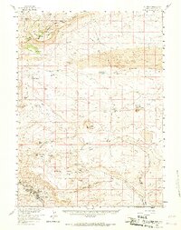
1958 Map of Superior
USGS Topo · Published 1967About this map
The high desert of Sweetwater County is dominated by the massive landforms of Zirkel Mesa and Steamboat Mountain in this late 1950s survey. The landscape is defined by the Continental Divide, which snakes through the northern hills above the coal-mining communities of Superior and South Superior. While the Union Pacific railroad serves the industrial southern corner of the map, the interior remains a vast expanse of high-plateau geography, including the Sand Dunes and the prominent Lucite Hills.
Find a feature on this map
48 named features on this map. Tap any name to fly to it.
Don’t see what you’re looking for? This feature index may not catch every label — zoom into the map to look around manually.
Map Details
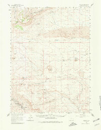
Editions of this 1958 Superior Map
3 editions found

Other maps of this area

1908 · Rock Springs
USGS Topo · 1:62,500

1910 · Rock Springs
USGS Topo · 1:62,500

1954 · Rock Springs
USGS Topo · 1:250,000

1955 · Lander
USGS Topo · 1:250,000

1958 · Lander
USGS Topo · 1:250,000

1958 · Rock Springs
USGS Topo · 1:250,000

1958 · Essex Mountain
USGS Topo · 1:62,500

1958 · Boars Tusk
USGS Topo · 1:62,500

1958 · Twelvemile Well
USGS Topo · 1:62,500

1958 · Freighter Gap
USGS Topo · 1:62,500