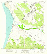
1959 Map of Surf
USGS Topo · Published 1961About this map
Vandenberg Air Force Base dominates the northern coastal landscape of this late 1950s survey, marking a significant era of Cold War military expansion along the California coast. The installation sits atop Burton Mesa, while to the south, the U S Naval Missile Facility Arguello occupies the Lompoc Terrace. This period of heavy federal presence is contrasted by remnants of earlier settlement and local infrastructure, such as the Southern Pacific railroad line following the shoreline and the historical Lompoc Landing (Site). The Santa Ynez River carves a wide valley between the military installations, providing a natural corridor where the settlements of Surf and Baroda are located. Further inland, the presence of the Artesia School and Radio Tower KNEZ near the community of La Salle illustrates the established agricultural and civilian life existing alongside the massive military reserves.
Find a feature on this map
38 named features on this map. Tap any name to fly to it.
Don’t see what you’re looking for? This feature index may not catch every label — zoom into the map to look around manually.
Map Details
Editions of this 1959 Surf Map
4 editions found
Other maps of this area

1905 · Guadalupe
USGS Topo · 1:125,000

1905 · Lompoc
USGS Topo · 1:125,000

1942 · Point Arguello
USGS Topo · 1:62,500

1942 · Guadalupe
USGS Topo · 1:125,000

1942 · Lompoc
USGS Topo · 1:125,000

1942 · Lompoc
USGS Topo · 1:62,500

1942 · Santa Maria
USGS Topo · 1:62,500

1942 · Point Sal
USGS Topo · 1:62,500

1943 · Lompoc
USGS Topo · 1:125,000

1947 · Lompoc
USGS Topo · 1:24,000