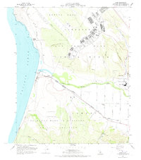
1959 Map of Surf
USGS Topo · Published 1973About this map
Vandenberg Air Force Base dominates this coastal landscape north of Point Arguello, a region transitioning into a high-technology military hub during the late 1950s. The map captures the extensive infrastructure of the U S Naval Missile Facility and the U S Disciplinary Barracks Mil Res, contrasting with the remnant agricultural and maritime history of the area. Along the shore, the Southern Pacific railroad connects small stop points like Surf and Baroda, while the historic Lompoc Landing (Site) serves as a reminder of earlier coastal shipping efforts.
Find a feature on this map
42 named features on this map. Tap any name to fly to it.
Don’t see what you’re looking for? This feature index may not catch every label — zoom into the map to look around manually.
Map Details
Editions of this 1959 Surf Map
4 editions found
Other maps of this area

1905 · Guadalupe
USGS Topo · 1:125,000

1905 · Lompoc
USGS Topo · 1:125,000

1942 · Point Arguello
USGS Topo · 1:62,500

1942 · Guadalupe
USGS Topo · 1:125,000

1942 · Lompoc
USGS Topo · 1:125,000

1942 · Lompoc
USGS Topo · 1:62,500

1942 · Santa Maria
USGS Topo · 1:62,500

1942 · Point Sal
USGS Topo · 1:62,500

1943 · Lompoc
USGS Topo · 1:125,000

1947 · Lompoc
USGS Topo · 1:24,000