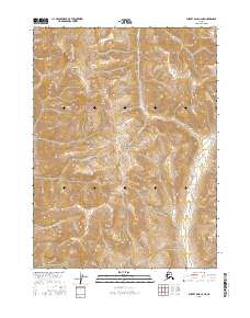
2016 Map of Survey Pass C-2 NE
USGS Topo · Published 2016About this map
Gates of the Arctic National Park encompasses the vast majority of this landscape, reflecting a strictly preserved wilderness in the Brooks Range during the early 21st century. The terrain is defined by extreme elevation changes, with the massive presence of Dalimaloak Mtn dominating the northern portion of the sheet. Drainage patterns are clearly delineated, showing the headwaters and course of Dalimaloak Cr as it flows south toward the larger valley of the Pingaluk River. Unlike more settled regions, this survey lacks any human infrastructure, roads, or permanent settlements, instead providing a precise topographic study of the public land system boundaries, including t27n r23e and t26n r24e. This map serves as an essential record of the untouched interior of Alaska, where land management boundaries are the only evidence of administrative presence in a purely natural environment.
Find a feature on this map
8 named features on this map. Tap any name to fly to it.
Don’t see what you’re looking for? This feature index may not catch every label — zoom into the map to look around manually.
Map Details
Editions of this 2016 Survey Pass C-2 NE Map
This is the sole edition of this map. No revisions or reprints were ever made.
Other maps of this area

1951 · Survey Pass
USGS Topo · 1:250,000

1956 · Survey Pass
USGS Topo · 1:250,000

1964 · Survey Pass
USGS Topo · 1:250,000

1966 · Survey Pass
USGS Topo · 1:250,000
1986 · Survey Pass D-1
USGS Topo · 1:63,360
1986 · Survey Pass C-2
USGS Topo · 1:63,360
1986 · Survey Pass C-1
USGS Topo · 1:63,360
1986 · Survey Pass D-2
USGS Topo · 1:63,360
2016 · Survey Pass C-2 NW
USGS Topo · 1:25,000
2016 · Survey Pass D-1 SW
USGS Topo · 1:25,000