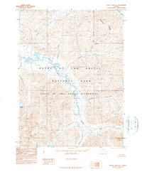
1990 Map of Survey Pass C-5
USGS Topo · Published 1990About this map
Gates of the Arctic National Park dominates this subarctic landscape, where the Continental Divide winds through the northern reaches of the Northwest Arctic Borough. The hydrology of the region is defined by the massive drainage systems of the Noatak River and the Alatna River, which are fed by numerous tributaries including Twelvemile Creek, Portage Creek, and Anorat Creek. This 1990 provisional edition provides a precise look at the mountain peaks and drainage basins of the Gates of the Arctic Wilderness as they were surveyed from aerial photography in the late 1970s and early 1980s. Notable landforms like Oyukak Mountain stand as primary reference points in a vast network of unnamed peaks and ridges, illustrating the untouched character of the Brooks Range before more modern ecological shifts. The absence of roads or trails emphasizes the region's status as a protected wilderness area.
Find a feature on this map
15 named features on this map. Tap any name to fly to it.
Don’t see what you’re looking for? This feature index may not catch every label — zoom into the map to look around manually.
Map Details
Editions of this 1990 Survey Pass C-5 Map
This is the sole edition of this map. No revisions or reprints were ever made.
Other maps of this area

1951 · Survey Pass
USGS Topo · 1:250,000

1956 · Survey Pass
USGS Topo · 1:250,000

1964 · Survey Pass
USGS Topo · 1:250,000

1966 · Survey Pass
USGS Topo · 1:250,000
1984 · Survey Pass D-6
USGS Topo · 1:63,360
1986 · Survey Pass D-5
USGS Topo · 1:63,360
1986 · Survey Pass D-4
USGS Topo · 1:63,360
1986 · Survey Pass C-4
USGS Topo · 1:63,360
1990 · Survey Pass B-5
USGS Topo · 1:63,360
1990 · Survey Pass B-4
USGS Topo · 1:63,360