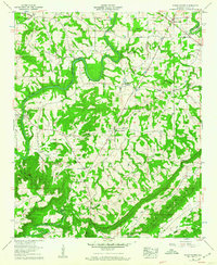
1958 Map of Susan Moore
USGS Topo · Published 1960About this map
The Locust Fork Black Warrior River snakes through the center of this landscape, its deep bends and riverine terrain defining the passage from Sand Mountain down into Murphree Valley. In the late 1950s, this portion of Blount County was characterized by small agricultural crossroads and rural faith centers. Settlements like Snead Crossroads and Susan Moore (Clarence) serve as primary anchors, while smaller communities such as Wynnville and Hendrix dot the map.
Find a feature on this map
54 named features on this map. Tap any name to fly to it.
Don’t see what you’re looking for? This feature index may not catch every label — zoom into the map to look around manually.
Map Details
Editions of this 1958 Susan Moore Map
3 editions found
Other maps of this area

1885 · Gadsden
USGS Topo · 1:125,000

1888 · Cullman
USGS Topo · 1:125,000

1888 · Gadsden
USGS Topo · 1:125,000

1889 · Springville
USGS Topo · 1:125,000

1889 · Birmingham
USGS Topo · 1:125,000

1892 · Cullman
USGS Topo · 1:125,000

1892 · Birmingham
USGS Topo · 1:125,000

1892 · Springville
USGS Topo · 1:125,000

1892 · Gadsden
USGS Topo · 1:125,000

1895 · Gadsden
USGS Topo · 1:125,000