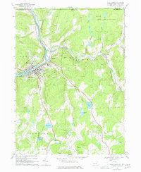
1968 Map of Susquehanna
USGS Topo · Published 1977About this map
The Susquehanna River carves a sharp turn through this northern Susquehanna County landscape, where the neighboring boroughs of Susquehanna and Oakland are linked by bridges over the water. This era is defined by the convergence of major rail lines, including the Erie-Lackawanna and the Delaware and Hudson, which follow the riverbanks and the winding path of Starrucca Creek. The infrastructure of these transportation hubs is evident in the dense network of quarries and gravel pits that dot the hillsides, supporting the industrial growth of Lanesboro and Jefferson Junction.
Find a feature on this map
59 named features on this map. Tap any name to fly to it.
Don’t see what you’re looking for? This feature index may not catch every label — zoom into the map to look around manually.
Map Details
Editions of this 1968 Susquehanna Map
4 editions found
Other maps of this area

1905 · Nineveh
USGS Topo · 1:62,500

1924 · Starrucca
USGS Topo · 1:48,000

1924 · Deposit
USGS Topo · 1:62,500

1926 · Deposit
USGS Topo · 1:62,500

1926 · Starrucca
USGS Topo · 1:62,500

1930 · Starrucca
USGS Topo · 1:48,000

1932 · Susquehanna
USGS Topo · 1:62,500

1933 · Starrucca
USGS Topo · 1:62,500

1935 · Susquehanna
USGS Topo · 1:62,500

1943 · Honesdale
USGS Topo · 1:125,000