
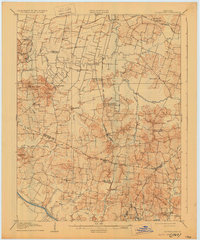
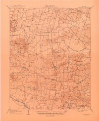
1906 Map of Sutherland
USGS Topo · Published 1906About this map
Sutherland and the rural communities of southern Daviess County are captured here just after the turn of the century, showing a landscape defined by meandering watercourses and a growing rail network. The Louisville and Nashville (Owensboro Branch) cuts north-to-south through the center of the sheet, connecting towns like Utica and Livia with the larger hub of Owensboro to the north. A fascinating dual designation appears at Browns Valley PO Crow Hickman Sta, indicating the era's reliance on both postal service and rail infrastructure for local identity.
Find a feature on this map
48 named features on this map. Tap any name to fly to it.
Don’t see what you’re looking for? This feature index may not catch every label — zoom into the map to look around manually.
Map Details
Editions of this 1906 Sutherland Map
3 editions found
Other maps of this area

1901 · Owensboro
USGS Topo · 1:62,500

1903 · Tell City
USGS Topo · 1:62,500

1905 · Newburg
USGS Topo · 1:62,500

1907 · Whitesville
USGS Topo · 1:62,500

1908 · Calhoun
USGS Topo · 1:62,500

1909 · Whitesville
USGS Topo · 1:62,500

1909 · Madisonville
USGS Topo · 1:62,500

1909 · Hartford
USGS Topo · 1:62,500

1909 · Central City
USGS Topo · 1:62,500

1952 · Owensboro East
USGS Topo · 1:24,000