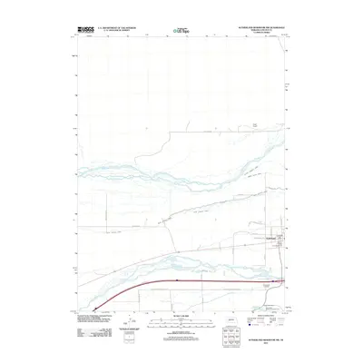
2011 Map of Sutherland Reservoir NW
USGS Topo · Published 2011About this map
The village of Sutherland serves as the focal point for this landscape where the North Platte River and South Platte River flow in close proximity. This corridor in Lincoln County is defined by an intricate network of water management, featuring several significant irrigation channels including the Paxton Hershey Canal, the North Platte Canal, and the Keith Lincoln Canal. These canals trace the natural contours of the Platte valley, supporting the agricultural economy of the Nebraska plains.
Find a feature on this map
31 named features on this map. Tap any name to fly to it.
Don’t see what you’re looking for? This feature index may not catch every label — zoom into the map to look around manually.
Map Details
Editions of this 2011 Sutherland Reservoir NW Map
This is the sole edition of this map. No revisions or reprints were ever made.
Other maps of this area

1898 · Paxton
USGS Topo · 1:125,000

1901 · Paxton
USGS Topo · 1:125,000

1954 · North Platte
USGS Topo · 1:250,000

1956 · North Platte
USGS Topo · 1:250,000

1957 · North Platte
USGS Topo · 1:250,000

1967 · North Platte
USGS Topo · 1:250,000

1971 · Sutherland Reservoir West
USGS Topo · 1:24,000
1971 · Paxton South
USGS Topo · 1:24,000
1971 · Paxton North
USGS Topo · 1:24,000
1971 · Hershey West
USGS Topo · 1:24,000