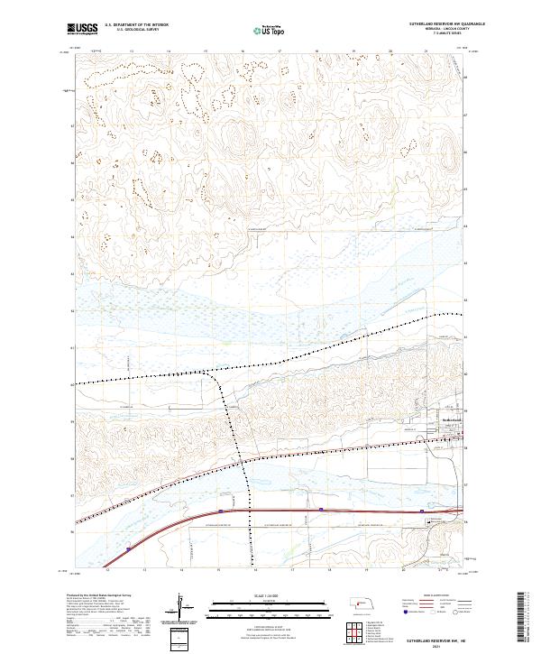
2021 Map of Sutherland Reservoir NW
USGS Topo · Published 2021About this map
The North Platte River and South Platte River converge toward each other in this portion of Lincoln County, defining a landscape dominated by sophisticated water management for Nebraska agriculture. The village of Sutherland sits in the eastern portion of the map, serving as a hub for the surrounding rural sections. The area is interlaced with an extensive network of irrigation infrastructure, including the Paxton Canal, Keith Lincoln Canal, N Platte Canal, and the Paxton Hershey Canal, alongside smaller features like Bull Ditch.
Find a feature on this map
46 named features on this map. Tap any name to fly to it.
Don’t see what you’re looking for? This feature index may not catch every label — zoom into the map to look around manually.
Map Details
Editions of this 2021 Sutherland Reservoir NW Map
This is the sole edition of this map. No revisions or reprints were ever made.
Other maps of this area

1898 · Paxton
USGS Topo · 1:125,000

1901 · Paxton
USGS Topo · 1:125,000

1954 · North Platte
USGS Topo · 1:250,000

1956 · North Platte
USGS Topo · 1:250,000

1957 · North Platte
USGS Topo · 1:250,000

1967 · North Platte
USGS Topo · 1:250,000

1971 · Sutherland Reservoir West
USGS Topo · 1:24,000
1971 · Paxton South
USGS Topo · 1:24,000
1971 · Paxton North
USGS Topo · 1:24,000
1971 · Hershey West
USGS Topo · 1:24,000