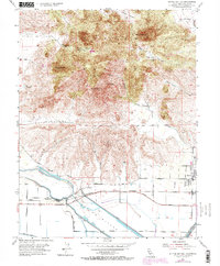
1954 Map of Sutter Buttes
USGS Topo · Published 1974About this map
The volcanic peaks of the Sutter Buttes rise abruptly from the surrounding Sacramento Valley floor, dominating this mid-century landscape. To the north, prominent summits including North Butte, West Butte, and South Butte are carved by deep drainages such as The Falls Canyon and Brockman Canyon. The lowlands to the south reveal a highly engineered agricultural environment, where the Sutter Bypass and an extensive Levee system manage the drainage of Butte Slough.
Find a feature on this map
40 named features on this map. Tap any name to fly to it.
Don’t see what you’re looking for? This feature index may not catch every label — zoom into the map to look around manually.
Map Details
Editions of this 1954 Sutter Buttes Map
4 editions found
Other maps of this area

1888 · Marysville
USGS Topo · 1:125,000

1891 · Marysville
USGS Topo · 1:125,000

1894 · Marysville
USGS Topo · 1:125,000

1895 · Marysville
USGS Topo · 1:125,000

1911 · Sutter
USGS Topo · 1:31,680

1911 · Sanborn Slough
USGS Topo · 1:31,680

1911 · Grimes
USGS Topo · 1:31,680

1911 · Gilsizer Slough
USGS Topo · 1:31,680

1912 · Marysville Buttes
USGS Topo · 1:31,680

1912 · Pennington
USGS Topo · 1:31,680