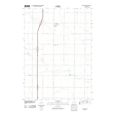
2010 Map of Swaledale
USGS Topo · Published 2010About this map
Swaledale and the eastern edge of Thornton anchor this rural Cerro Gordo County landscape, where the agricultural grid is intersected by the winding paths of several regional waterways. The Swaledale Post Office sits at the heart of the community, while the surrounding countryside is marked by significant local landmarks including Shobes Grove and the Richland Lutheran Cemetery. The terrain is defined by the drainage systems of Beaverdam Creek and its West Branch, alongside Bailey Creek and Otter Creek. These streams create natural breaks in the rectangular road network, which is composed of named routes such as Killdeer Ave and Mallard Ave. For genealogists and local historians, the map provides precise locations for the Pleasant Valley Township Cemetery, offering a clear view of the township’s spatial organization at the beginning of the 21st century.
Find a feature on this map
27 named features on this map. Tap any name to fly to it.
Don’t see what you’re looking for? This feature index may not catch every label — zoom into the map to look around manually.
Map Details
Editions of this 2010 Swaledale Map
This is the sole edition of this map. No revisions or reprints were ever made.
Other maps of this area

1954 · Mason City
USGS Topo · 1:250,000

1954 · Waterloo
USGS Topo · 1:250,000

1955 · Waterloo
USGS Topo · 1:250,000

1957 · Mason City
USGS Topo · 1:250,000

1958 · Mason City
USGS Topo · 1:250,000

1959 · Mason City
USGS Topo · 1:62,500

1959 · Hanford
USGS Topo · 1:24,000

1972 · Alexander
USGS Topo · 1:24,000

1972 · Thornton
USGS Topo · 1:24,000

1972 · Swaledale
USGS Topo · 1:24,000