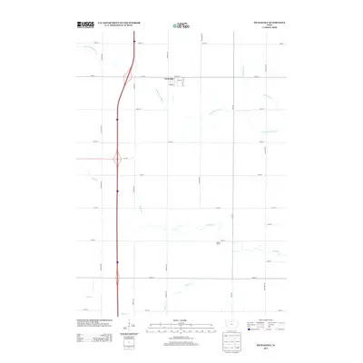
2013 Map of Swaledale
USGS Topo · Published 2013About this map
Swaledale serves as the primary community in this North Central Iowa landscape, concentrated along Main St and Arthur St. The town is situated on the edge of a vast agricultural grid defined by meticulously numbered avenues and streets, including Killdeer Ave and Lark Ave. The natural geography is dominated by several converging waterways that break the geometric precision of the farm plots. These include the winding paths of W Br Beaverdam Cr, Beaverdam Cr, Bailey Cr, and Otter Cr. A major interstate highway cuts a modern north-south path through the western portion of the region, creating a stark contrast with the local street network of Swaledale. The survey provides a clear view of the rural infrastructure during the early twenty-first century, documenting the intersection of modern transportation corridors with traditional small-town Iowa life.
Find a feature on this map
28 named features on this map. Tap any name to fly to it.
Don’t see what you’re looking for? This feature index may not catch every label — zoom into the map to look around manually.
Map Details
Editions of this 2013 Swaledale Map
This is the sole edition of this map. No revisions or reprints were ever made.
Other maps of this area

1954 · Mason City
USGS Topo · 1:250,000

1954 · Waterloo
USGS Topo · 1:250,000

1955 · Waterloo
USGS Topo · 1:250,000

1957 · Mason City
USGS Topo · 1:250,000

1958 · Mason City
USGS Topo · 1:250,000

1959 · Mason City
USGS Topo · 1:62,500

1959 · Hanford
USGS Topo · 1:24,000

1972 · Alexander
USGS Topo · 1:24,000

1972 · Thornton
USGS Topo · 1:24,000

1972 · Swaledale
USGS Topo · 1:24,000