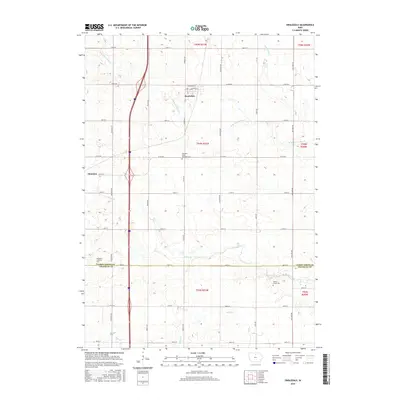
2015 Map of Swaledale
USGS Topo · Published 2015About this map
Swaledale serves as the primary settlement in this north-central Iowa landscape, situated along the northern reaches of the W Br Beaverdam Cr. This 2015 update illustrates a highly structured agricultural grid, where townships like t94n r21w are bisected by modern corridors and established county roads such as Co RD b60. The map documents the persistent rural infrastructure of the region, featuring several small, dispersed burial grounds including the Richland Lutheran Cem and the Shobes Grove Cem. These sites, along with the Pleasant Valley Township Cem, offer vital touchstones for genealogical research in this part of the state. Waterways like Bailey Creek and Otter Cr cut diagonally across the section lines, defining the natural drainage patterns that have shaped local farming for generations.
Find a feature on this map
38 named features on this map. Tap any name to fly to it.
Don’t see what you’re looking for? This feature index may not catch every label — zoom into the map to look around manually.
Map Details
Editions of this 2015 Swaledale Map
This is the sole edition of this map. No revisions or reprints were ever made.
Other maps of this area

1954 · Mason City
USGS Topo · 1:250,000

1954 · Waterloo
USGS Topo · 1:250,000

1955 · Waterloo
USGS Topo · 1:250,000

1957 · Mason City
USGS Topo · 1:250,000

1958 · Mason City
USGS Topo · 1:250,000

1959 · Mason City
USGS Topo · 1:62,500

1959 · Hanford
USGS Topo · 1:24,000

1972 · Alexander
USGS Topo · 1:24,000

1972 · Thornton
USGS Topo · 1:24,000

1972 · Swaledale
USGS Topo · 1:24,000