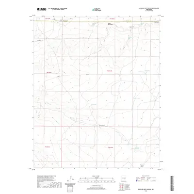
2020 Map of Swallow Nest Canyon
USGS Topo · Published 2020About this map
Swallow Nest Canyon defines the upper reaches of this New Mexico landscape, where the boundary between Chaves and De Baca counties crosses a network of drainages and seasonal water sources. The map documents a sparsely populated ranching environment where life revolves around reliable water, indicated by named features like Blue Hole Spring, Coyote Spring, and Rattlesnake Spring. Infrastructure is limited to a few arterial dirt routes such as Colfax Rd and Spike Box Rd, which navigate the elevation changes around Rattlesnake Canyon and Coyote Canyon. Evidence of land management and livestock operations appears in the presence of Drake Tank, Redman Tank, and North Tank, which serve as vital collection points in an area otherwise dominated by the intermittent flows of Horse Cr and Wylie Draw.
Find a feature on this map
26 named features on this map. Tap any name to fly to it.
Don’t see what you’re looking for? This feature index may not catch every label — zoom into the map to look around manually.
Map Details
Editions of this 2020 Swallow Nest Canyon Map
This is the sole edition of this map. No revisions or reprints were ever made.
Other maps of this area

1954 · Fort Sumner
USGS Topo · 1:250,000

1955 · Roswell
USGS Topo · 1:250,000

1958 · Fort Sumner
USGS Topo · 1:250,000

1958 · Roswell
USGS Topo · 1:250,000

1962 · Roswell
USGS Topo · 1:250,000

1967 · Deering Place
USGS Topo · 1:24,000

1967 · Cottonwood Draw
USGS Topo · 1:24,000

1967 · Dunlap Sill
USGS Topo · 1:24,000

1967 · Swallow Nest Canyon
USGS Topo · 1:24,000
1967 · Mesa SE
USGS Topo · 1:24,000