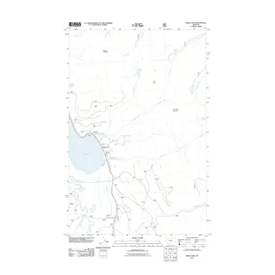
2011 Map of Swan Lake
USGS Topo · Published 2011About this map
Swan Lake and the small settlement along its eastern shore dominate this landscape in Lake County, where the Swan River flows through a narrow valley flanked by high peaks. The community is anchored by the Swan Lake Vol Fire Dept and provides access to the Swan Lake Campground, reflecting the area's importance for local service and recreation. To the east, the terrain rises sharply toward Con Kelley Mountain and Hall Peak, drained by numerous waterways including Bond Creek and Hall Creek.
Find a feature on this map
26 named features on this map. Tap any name to fly to it.
Don’t see what you’re looking for? This feature index may not catch every label — zoom into the map to look around manually.
Map Details
Editions of this 2011 Swan Lake Map
This is the sole edition of this map. No revisions or reprints were ever made.
Other maps of this area

1914 · Nyack
USGS Topo · 1:125,000

1955 · Choteau
USGS Topo · 1:250,000

1957 · Choteau
USGS Topo · 1:250,000

1958 · Choteau
USGS Topo · 1:250,000

1958 · Quintonkon
USGS Topo · 1:24,000

1960 · Cut Bank
USGS Topo · 1:250,000

1962 · Choteau
USGS Topo · 1:250,000

1963 · Cut Bank
USGS Topo · 1:250,000

1964 · Cut Bank
USGS Topo · 1:250,000
1964 · Crater Lake
USGS Topo · 1:24,000