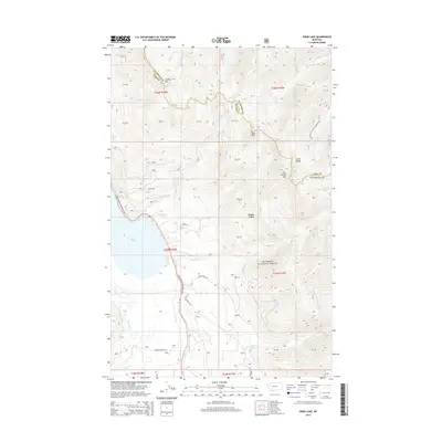
2014 Map of Swan Lake
USGS Topo · Published 2014About this map
Swan Lake dominates the central valley of this Montana landscape, where the Swan River flows south amidst the towering peaks of the Swan Range. The terrain is characterized by dramatic elevation changes, with Sixmile Mtn and Hall Peak defining the western ridges, while Con Kelley Mtn rises to the east within the Flathead National Forest. Transportation through this steep-walled corridor is primary along the Daryl Soltesz Memorial Hwy, which follows the lakeshore. A network of primitive routes and footpaths like the Bond Creek Trl and Six Mile Rd provide access to the higher elevations and remote alpine waters, including Trinkus Lake and Hall Lake. This mapping shows the modern balance of accessible recreation and preserved wilderness in Lake and Flathead Counties.
Find a feature on this map
35 named features on this map. Tap any name to fly to it.
Don’t see what you’re looking for? This feature index may not catch every label — zoom into the map to look around manually.
Map Details
Editions of this 2014 Swan Lake Map
This is the sole edition of this map. No revisions or reprints were ever made.
Other maps of this area

1914 · Nyack
USGS Topo · 1:125,000

1955 · Choteau
USGS Topo · 1:250,000

1957 · Choteau
USGS Topo · 1:250,000

1958 · Choteau
USGS Topo · 1:250,000

1958 · Quintonkon
USGS Topo · 1:24,000

1960 · Cut Bank
USGS Topo · 1:250,000

1962 · Choteau
USGS Topo · 1:250,000

1963 · Cut Bank
USGS Topo · 1:250,000

1964 · Cut Bank
USGS Topo · 1:250,000
1964 · Crater Lake
USGS Topo · 1:24,000