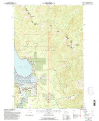
1994 Map of Swan lake
USGS Topo · Published 1996About this map
The northern reaches of Swan Lake serve as the focal point for this mid-1990s survey, illustrating the convergence of recreational waters and protected wildlife habitats in Lake and Flathead counties. The map details the transition from the open water at the Swan Lake Boat Launch to the complex wetlands of the Swan River National Wildlife Refuge at the lake's southern inlet. The Swan River meanders through these marshes, flanked by numerous small tributaries like Spring Creek.
Find a feature on this map
27 named features on this map. Tap any name to fly to it.
Don’t see what you’re looking for? This feature index may not catch every label — zoom into the map to look around manually.
Map Details
Editions of this 1994 Swan lake Map
This is the sole edition of this map. No revisions or reprints were ever made.
Other maps of this area

1914 · Nyack
USGS Topo · 1:125,000

1955 · Choteau
USGS Topo · 1:250,000

1957 · Choteau
USGS Topo · 1:250,000

1958 · Choteau
USGS Topo · 1:250,000

1958 · Quintonkon
USGS Topo · 1:24,000

1960 · Cut Bank
USGS Topo · 1:250,000

1962 · Choteau
USGS Topo · 1:250,000

1963 · Cut Bank
USGS Topo · 1:250,000

1964 · Cut Bank
USGS Topo · 1:250,000
1964 · Crater Lake
USGS Topo · 1:24,000