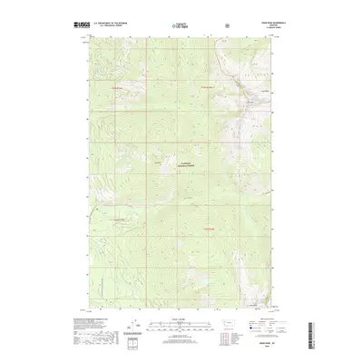
2020 Map of Swan Peak
USGS Topo · Published 2020About this map
Swan Peak and Van Peak dominate this high-altitude section of the Swan Range within the Flathead National Forest. This 2020 survey documents the complex drainage systems of the Montana backcountry, where watercourses like Squeezer Cr, Scout Cr, and Bethel Cr flow through steep glacial terrain. The map details the remote transition between Flathead and Lake Counties, showing the vital watershed connections of Pony Lake and Cat Lake.
Find a feature on this map
24 named features on this map. Tap any name to fly to it.
Don’t see what you’re looking for? This feature index may not catch every label — zoom into the map to look around manually.
Map Details
Editions of this 2020 Swan Peak Map
This is the sole edition of this map. No revisions or reprints were ever made.
Other maps of this area

1955 · Choteau
USGS Topo · 1:250,000

1957 · Choteau
USGS Topo · 1:250,000

1958 · Choteau
USGS Topo · 1:250,000

1962 · Choteau
USGS Topo · 1:250,000

1965 · Peck Lake
USGS Topo · 1:24,000

1965 · Condon
USGS Topo · 1:24,000

1965 · Sunburst Lake
USGS Topo · 1:24,000
1965 · Thunderbolt Mountain
USGS Topo · 1:24,000

1965 · Swan Peak
USGS Topo · 1:24,000
1965 · Cilly Creek
USGS Topo · 1:24,000