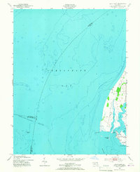
1953 Map of Swan Point
USGS Topo · Published 1967About this map
Chesapeake Bay dominates this mid-century maritime survey, documenting the critical waterways and coastal settlements of Kent County's western edge. The map captures the working waterfronts of Rock Hall and Gratitude, where the local economy centered on the protected inlets of The Haven and Swan Creek. This era of the Eastern Shore's history is reflected in the numerous landings and points, such as Deep Landing and Windmill Point, which define the transition from open bay to navigable creek. Significant underwater features and maritime infrastructure are meticulously noted, including the Brewerton Channel Eastern Extension with its documented project depth of 27 feet. Landmarks like Tower No 12 and Tower No 14 serve as navigational aids along the shore near Swan Point, while the surrounding waters show the bathymetry of the Swan Point Bar and the submerged Ninefoot Knoll.
Find a feature on this map
19 named features on this map. Tap any name to fly to it.
Don’t see what you’re looking for? This feature index may not catch every label — zoom into the map to look around manually.
Map Details
Editions of this 1953 Swan Point Map
2 editions found
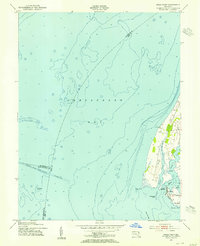
Other maps of this area

1893 · North Point
USGS Topo · 1:62,500

1893 · Gunpowder
USGS Topo · 1:62,500

1898 · Tolchester
USGS Topo · 1:125,000

1900 · Betterton
USGS Topo · 1:62,500

1901 · Chestertown
USGS Topo · 1:62,500

1901 · Gunpowder
USGS Topo · 1:62,500

1903 · Tolchester
USGS Topo · 1:125,000

1904 · North Point
USGS Topo · 1:62,500

1908 · Tolchester
USGS Topo · 1:125,000

1920 · Chestertown
USGS Topo · 1:62,500
Featured Places
- Rock Hall, MD
- Deep Landing, Rock Hall
- Little Neck Farms, MD
- Gratitude, Rock Hall
- Anne Arundel County, MD