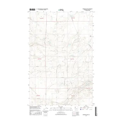
2017 Map of Swanson Lakes
USGS Topo · Published 2017About this map
Swanson Lakes and the surrounding coulee landscape of Lincoln County define this portion of the Channeled Scablands. This 2017 survey details a region characterized by numerous small water bodies and seasonal basins, including Flat Lake, Phillips Lake, and the elongated Coffeepot Lake at the southern margin. The terrain is marked by structural features like Marlin Hollow and the local landmark Rock Cut Bridge.
Find a feature on this map
29 named features on this map. Tap any name to fly to it.
Don’t see what you’re looking for? This feature index may not catch every label — zoom into the map to look around manually.
Map Details
Editions of this 2017 Swanson Lakes Map
This is the sole edition of this map. No revisions or reprints were ever made.
Other maps of this area

1953 · Ritzville
USGS Topo · 1:250,000

1959 · Ritzville
USGS Topo · 1:250,000

1965 · Ritzville
USGS Topo · 1:250,000

1968 · Coffeepot Lake
USGS Topo · 1:24,000

1968 · Pacific Lake
USGS Topo · 1:24,000

1969 · Rocklyn SW
USGS Topo · 1:24,000

1969 · Cormana Lake
USGS Topo · 1:24,000

1969 · Telford
USGS Topo · 1:24,000

1969 · Creston Butte
USGS Topo · 1:24,000

1969 · Wagner Lake
USGS Topo · 1:24,000