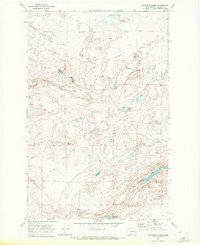
1969 Map of Swanson Lakes
USGS Topo · Published 1972About this map
Swanson Lakes and the surrounding coulee terrain of Lincoln County dominate this 1960s landscape, characterized by numerous scabland water bodies and seasonal springs. The map documents the intricate geological depressions of Marlin Hollow and the scattered lake systems that define the Channeled Scablands. A network of unimproved routes and a Jeep Trail provide the primary access through this sparsely settled region, where the economy was tied to remote ranching and land management. Researchers can trace the varied hydrology of the area through labels like Wall Lake, Twin Lakes, and Rock Lake, alongside numerous unnamed springs and wells. The inclusion of localized landmarks such as a Gravel Pit and several fence lines, marked by fine red dashed lines, offers a granular view of rural land use and boundary marking in central Washington during the late twentieth century.
Find a feature on this map
20 named features on this map. Tap any name to fly to it.
Don’t see what you’re looking for? This feature index may not catch every label — zoom into the map to look around manually.
Map Details
Editions of this 1969 Swanson Lakes Map
This is the sole edition of this map. No revisions or reprints were ever made.
Other maps of this area

1953 · Ritzville
USGS Topo · 1:250,000

1959 · Ritzville
USGS Topo · 1:250,000

1965 · Ritzville
USGS Topo · 1:250,000

1968 · Coffeepot Lake
USGS Topo · 1:24,000

1968 · Pacific Lake
USGS Topo · 1:24,000

1969 · Rocklyn SW
USGS Topo · 1:24,000

1969 · Cormana Lake
USGS Topo · 1:24,000

1969 · Telford
USGS Topo · 1:24,000

1969 · Creston Butte
USGS Topo · 1:24,000

1969 · Wagner Lake
USGS Topo · 1:24,000