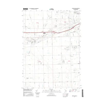
2017 Map of Swartz Creek
USGS Topo · Published 2017About this map
The city of Swartz Creek and the western periphery of Flint define the landscape of this 2017 survey. The region is characterized by a dense network of suburban developments and drainage infrastructure, such as the Howland Drain and Sprague Drain, supporting the transition from the industrial hubs of Genesee County into the surrounding townships. Aviation history is prominent on this sheet, featuring the expansive Bishop International Airport alongside the smaller Barnstormers Airport to the southwest. For genealogists and local historians, the map preserves the locations of numerous community landmarks including Saint Marys Cem, the Dart Family Cem, and Pierce Cem. To the southeast, the small settlement of Rankin sits near several tributaries like Indian Cr, illustrating the area's continued reliance on a complex system of creeks and man-made drains.
Find a feature on this map
122 named features on this map. Tap any name to fly to it.
Don’t see what you’re looking for? This feature index may not catch every label — zoom into the map to look around manually.
Map Details
Editions of this 2017 Swartz Creek Map
This is the sole edition of this map. No revisions or reprints were ever made.
Other maps of this area

1919 · Burt
USGS Topo · 1:62,500

1920 · Flint
USGS Topo · 1:62,500

1920 · Holly
USGS Topo · 1:62,500

1921 · Burt
USGS Topo · 1:62,500

1922 · Holly
USGS Topo · 1:62,500

1922 · Durand
USGS Topo · 1:62,500

1922 · Flint
USGS Topo · 1:62,500

1943 · Holly
USGS Topo · 1:62,500

1943 · Burt
USGS Topo · 1:62,500

1943 · Durand
USGS Topo · 1:62,500