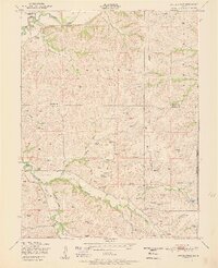
1951 Map of Swede Creek
USGS Topo · Published 1951About this map
The McDowell Creek valley defines this rural landscape on the borders of Riley, Geary, and Wabaunsee counties, where mid-century life was organized around small school districts and family cemeteries. At the time of this 1949 field check, the area remained deeply agricultural, characterized by a complex network of tributaries such as East McDowell Creek, West McDowell Creek, and Briggs Branch. This drainage system is dotted with numerous small reservoirs, indicating a landscape managed for water retention and livestock. Educational and community focal points are scattered throughout the hills, including Ashland School District 4 in the northwest and Briggs School further south. Local history is anchored by the Ashland Cemetery and Briggs Cemetery, which provide vital genealogical links to the families who settled the townships of Ashland, Zeandale, and Jackson. The map records a moment before major modern development, showing the original rural road network and isolated farmsteads.
Find a feature on this map
24 named features on this map. Tap any name to fly to it.
Don’t see what you’re looking for? This feature index may not catch every label — zoom into the map to look around manually.
Map Details
Editions of this 1951 Swede Creek Map
2 editions found

Other maps of this area

1885 · Eskridge
USGS Topo · 1:125,000

1886 · Junction City
USGS Topo · 1:125,000

1889 · Wamego
USGS Topo · 1:125,000

1889 · Junction City
USGS Topo · 1:125,000

1889 · Parkerville
USGS Topo · 1:125,000

1889 · Eskridge
USGS Topo · 1:125,000

1894 · Eskridge
USGS Topo · 1:125,000

1894 · Junction City
USGS Topo · 1:125,000

1894 · Parkerville
USGS Topo · 1:125,000

1894 · Wamego
USGS Topo · 1:125,000