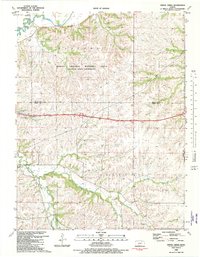
1982 Map of Swede Creek
USGS Topo · Published 1982About this map
The Konza Prairie Natural Area dominates the northern landscape of this survey, preserving a significant expanse of tallgrass prairie at the edge of the Flint Hills. To the northwest, the small community of Ashland is marked by the Ashland Cem, while the winding course of McDowell Creek and its many tributaries, such as East McDowell Creek and West McDowell Creek, dictate the local topography. This area, largely defined by ranching and agricultural use, shows the integration of educational research lands with local rural infrastructure. Landmarks like the McDowell Creek Sch and Briggs Cem provide valuable touchstones for genealogical research, while the presence of a Quarry and a network of named bridges, including MacArthur Br and Thierer Br, reflect the practical developments of the early 1980s landscape.
Find a feature on this map
26 named features on this map. Tap any name to fly to it.
Don’t see what you’re looking for? This feature index may not catch every label — zoom into the map to look around manually.
Map Details
Editions of this 1982 Swede Creek Map
2 editions found
Other maps of this area

1885 · Eskridge
USGS Topo · 1:125,000

1886 · Junction City
USGS Topo · 1:125,000

1889 · Wamego
USGS Topo · 1:125,000

1889 · Junction City
USGS Topo · 1:125,000

1889 · Parkerville
USGS Topo · 1:125,000

1889 · Eskridge
USGS Topo · 1:125,000

1894 · Eskridge
USGS Topo · 1:125,000

1894 · Junction City
USGS Topo · 1:125,000

1894 · Parkerville
USGS Topo · 1:125,000

1894 · Wamego
USGS Topo · 1:125,000