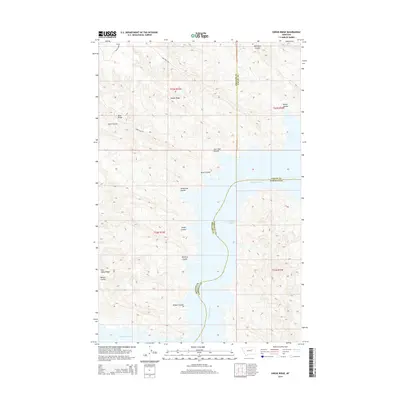
2014 Map of Swede Ridge
USGS Topo · Published 2014About this map
Fort Peck Lake and the Missouri River dominate this 2014 survey of the Big Sky country where Valley, Phillips, and Garfield Counties meet. The landscape is defined by its drainage patterns, with numerous coulees—deep ravines or gulches—cutting through the elevated terrain of Swede Ridge and Blue Ridge. The branching network of names like Hell Hole Coulee, Cart Trail Coulee, and Doney Coulee reveals the hydraulic erosion that has shaped this part of the Missouri Breaks. Infrastructure is sparse, primarily consisting of the Swede Ridge Rd and Larb Hills Rd, which provide access through the complex topography of Iron Stake Ridge. This map captures the remote character of the northern Montana prairie as it transitions into the large water bodies created by the Missouri’s impoundment.
Find a feature on this map
22 named features on this map. Tap any name to fly to it.
Don’t see what you’re looking for? This feature index may not catch every label — zoom into the map to look around manually.
Map Details
Editions of this 2014 Swede Ridge Map
This is the sole edition of this map. No revisions or reprints were ever made.
Other maps of this area

1954 · Jordan
USGS Topo · 1:250,000

1956 · Jordan
USGS Topo · 1:250,000

1958 · Jordan
USGS Topo · 1:250,000

1964 · Jordan
USGS Topo · 1:250,000

1965 · Coal Mine Hill
USGS Topo · 1:24,000

1965 · Pine Grove School
USGS Topo · 1:24,000

1965 · Schuyler Butte
USGS Topo · 1:24,000

1971 · Wolfe Coulee
USGS Topo · 1:24,000

1971 · Sawmill Creek
USGS Topo · 1:24,000

1971 · Chalk Butte
USGS Topo · 1:24,000