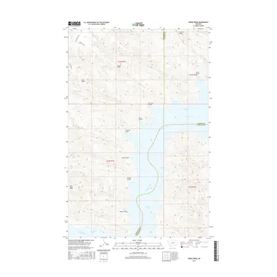
2017 Map of Swede Ridge
USGS Topo · Published 2017About this map
Fort Peck Lake dominates the southeastern portion of this landscape where the Missouri River meets the expansive reservoir at the border of Valley, Garfield, and Phillips Counties. This high-plains terrain is defined by a series of prominent ridges and drainage coulees that reveal the intricate natural irrigation and erosion patterns of the region. Swede Ridge and Blue Ridge provide significant topographic relief, while family-named or descriptive watercourses like Hell Hole Coulee and McCarty Coulee trace the descent toward the lake shore. Local access is maintained through specific upland routes such as Coal Mine Hill Rd and Swede Ridge Rd, reflecting the long-standing ranching and resource-based infrastructure of these northern Montana breaks.
Find a feature on this map
23 named features on this map. Tap any name to fly to it.
Don’t see what you’re looking for? This feature index may not catch every label — zoom into the map to look around manually.
Map Details
Editions of this 2017 Swede Ridge Map
This is the sole edition of this map. No revisions or reprints were ever made.
Other maps of this area

1954 · Jordan
USGS Topo · 1:250,000

1956 · Jordan
USGS Topo · 1:250,000

1958 · Jordan
USGS Topo · 1:250,000

1964 · Jordan
USGS Topo · 1:250,000

1965 · Coal Mine Hill
USGS Topo · 1:24,000

1965 · Pine Grove School
USGS Topo · 1:24,000

1965 · Schuyler Butte
USGS Topo · 1:24,000

1971 · Wolfe Coulee
USGS Topo · 1:24,000

1971 · Sawmill Creek
USGS Topo · 1:24,000

1971 · Chalk Butte
USGS Topo · 1:24,000