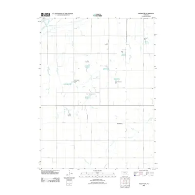
2011 Map of Swedehome
USGS Topo · Published 2011About this map
The settlement of Swedehome serves as the central landmark for this rural landscape in Polk County, Nebraska. This portion of the Central Platte Valley is characterized by a sophisticated network of agricultural water management systems, including numerous reservoirs and dams named for local families and purposes. Significant features include the Peterson Multi Purpose Reservoir, Kaczor Reservoir 1-B, and Berck Reservoir, which illustrate the intensive irrigation and flood control efforts essential to this farming region. The Beulah Cemetery provides a primary point of interest for genealogists tracing family roots in this Swedish-influenced community. The terrain is defined by the drainage of Clear Creek, Prairie Creek, and Davis Creek, which weave through the grid of county roads that organize the Nebraska plains. This map captures the interplay between natural watercourses and human-engineered grade stabilization and detention dams like the Grade Stabilization Dam 1-1.
Find a feature on this map
39 named features on this map. Tap any name to fly to it.
Don’t see what you’re looking for? This feature index may not catch every label — zoom into the map to look around manually.
Map Details
Editions of this 2011 Swedehome Map
This is the sole edition of this map. No revisions or reprints were ever made.
Other maps of this area

1896 · Stromsburg
USGS Topo · 1:125,000

1955 · Fremont
USGS Topo · 1:250,000

1957 · Fremont
USGS Topo · 1:250,000

1958 · Fremont
USGS Topo · 1:250,000

1958 · Silver Creek SE
USGS Topo · 1:24,000

1958 · Silver Creek
USGS Topo · 1:24,000

1958 · Havens
USGS Topo · 1:24,000

1962 · Polk
USGS Topo · 1:24,000
1962 · Swedehome
USGS Topo · 1:24,000
1962 · Clarks
USGS Topo · 1:24,000