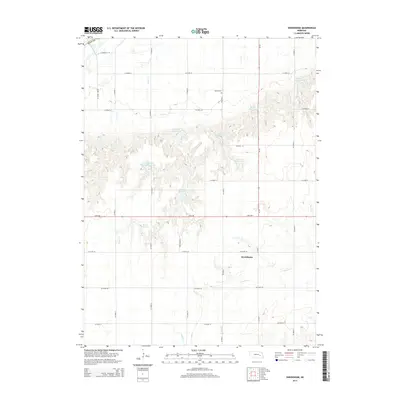
2014 Map of Swedehome
USGS Topo · Published 2014About this map
Swedehome serves as the focal point for this agrarian landscape in Polk County, where the plains are defined by a sophisticated network of water management. The topography is marked by numerous man-made impoundments, including the Peterson Multi Purpose Reservoir and Monson Reservoir, which support the intensive local farming economy. These water bodies are often named for local families, such as Buchta Reservoir, Berck Reservoir, and Kaczor Reservoir 1-B, providing a clear record of land ownership and agricultural heritage in the early 21st century. The drainage patterns of Clear Creek, Prairie Creek, and Davis Creek dictate the layout of the section-line road system. Near the northern edge of the map, Beulah Cemetery stands as a quiet landmark of the community's history, situated along County Road 34.
Find a feature on this map
32 named features on this map. Tap any name to fly to it.
Don’t see what you’re looking for? This feature index may not catch every label — zoom into the map to look around manually.
Map Details
Editions of this 2014 Swedehome Map
This is the sole edition of this map. No revisions or reprints were ever made.
Other maps of this area

1896 · Stromsburg
USGS Topo · 1:125,000

1955 · Fremont
USGS Topo · 1:250,000

1957 · Fremont
USGS Topo · 1:250,000

1958 · Fremont
USGS Topo · 1:250,000

1958 · Silver Creek SE
USGS Topo · 1:24,000

1958 · Silver Creek
USGS Topo · 1:24,000

1958 · Havens
USGS Topo · 1:24,000

1962 · Polk
USGS Topo · 1:24,000
1962 · Swedehome
USGS Topo · 1:24,000
1962 · Clarks
USGS Topo · 1:24,000